International Travel Maps
Zurich & Northern Switzerland Travel Map by ITMB
Zurich & Northern Switzerland Travel Map by ITMB
Couldn't load pickup availability
Share
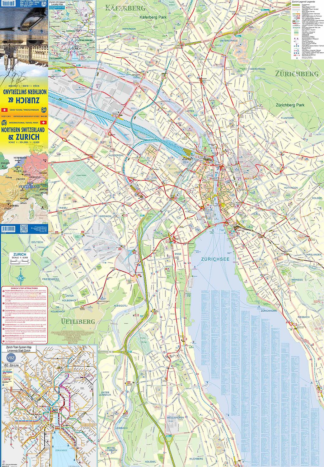
Explore Zurich and the sweeping beauty of northern Switzerland with ITMB’s double-sided, folded travel and reference map, a perfect companion for wanderers and planners alike. On Side 1, dive into the vibrant heart of Zurich, where the Limmat River flows through a charming, walkable old town centered on the bustling railway station. Wander along pedestrian promenades, take in the grand National Museum or climb to the Lindenhof for sweeping views of the city. Along the edge of the glittering Zurichsee, ferries glide to lakeside towns, offering both scenic day trips and daily commutes. To help you get around this transit-savvy city, the map features a detailed inset of Zurich’s trams, buses, and railways.
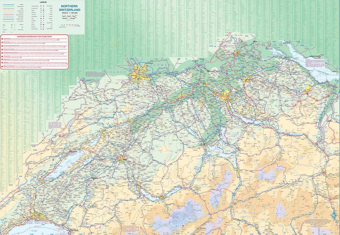
Flip to Side 2 and discover a regional guide that spans from Lausanne on the shores of Lake Geneva, across historic Bern with its arched walkways, through Basel’s cultural corridors, all the way to alpine Chur. With a scale of 1:301,000, this map highlights Switzerland’s impressive train network, ideal for exploring majestic landscapes and storybook towns like Luzern and St. Gallen. Roads, rivers, parks, and attractions are all clearly marked, making it easy to chart your own alpine adventure. Sized at 27” x 39”, it folds down neatly for easy use on the go.
SKU: SKU:ITMZURICH
View full details