National Geographic
Zion National Park Trails Illustrated Topographic Map #214
Zion National Park Trails Illustrated Topographic Map #214
Couldn't load pickup availability
Share
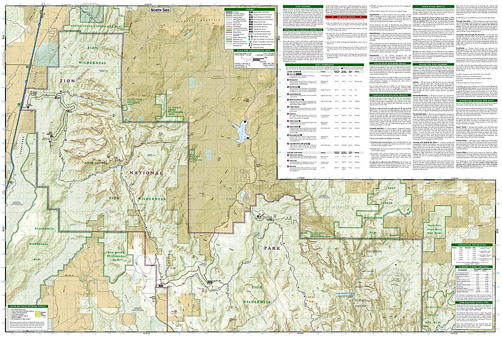
Discover the breathtaking landscapes of Zion National Park with National Geographic’s Trails Illustrated Topographic Map #214, the ultimate guide to exploring Utah’s first national park. Covering nearly ninety miles of hiking trails, this durable, waterproof map highlights some of the park’s most iconic attractions, including the world-famous Zion Narrows, the dramatic Kolob Canyons, and the stunning West Rim Trail, which leads to the unforgettable viewpoint of Angels Landing.
Rich in both detail and history, the map includes a geology chart that explains Zion’s remarkable Navajo sandstone cliffs, formed over 150 million years ago, as well as insights into the area’s Native American heritage and early Mormon settlers. Practical features like trail mileages, elevation contours, camping and lodging information, and a companion hiking timetable make planning easier than ever.
Designed in partnership with local land managers, this topographic map ensures your Zion adventure is safe, informed, and unforgettable.
SKU: SKU:TRA214
View full details