International Travel Maps
Yukon Territory BC North Travel Map
Yukon Territory BC North Travel Map
Couldn't load pickup availability
Share
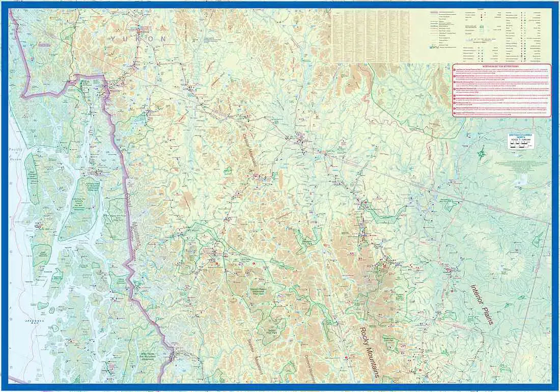
Yukon & British Columbia North Travel Map: The ITMB Yukon Territory & British Columbia North Travel Map is an essential companion for exploring one of North America's most captivating regions. Printed on durable paper at a scale of 1:1,400,000 & 1:900,000, this double-sided, folded map covers the vast expanse of the Yukon Territory along with northern British Columbia and the Alaskan Panhandle. Whether navigating the historic Alaska Highway or seeking out remote destinations, the map provides detailed coverage of road networks, topography, and key travel information.
The map highlights popular tourist destinations like Dawson City, renowned for its Klondike Gold Rush heritage, where visitors can step back in time amid preserved historic buildings. Whitehorse, the vibrant capital, serves as a gateway to the Yukon’s natural beauty, including the nearby Miles Canyon and scenic hiking trails. Further south, Watson Lake welcomes travelers with its famous Sign Post Forest, a quirky and ever-growing collection of signposts from around the globe.
Adventurous travelers will appreciate the depiction of the rugged Dempster Highway, the only road in Canada that reaches the Arctic Ocean. The reverse side of the map features northern British Columbia’s pristine landscapes, including the winding Stewart-Cassiar Highway, along with ferry routes through the Alaskan Panhandle’s breathtaking coastal scenery. Inset maps of Whitehorse, Dawson City, and Watson Lake offer additional detail for navigating these key hubs.
With its comprehensive legend marking roads classification, points of interest, national parks, and more, this map is an indispensable guide for both casual travelers and intrepid explorers venturing into Canada’s northern frontier.