National Geographic
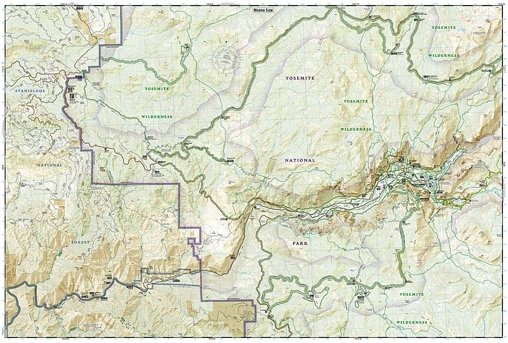
Yosemite National Park SW Trails Illustrated Topographic Map #306
Yosemite National Park SW Trails Illustrated Topographic Map #306
Couldn't load pickup availability
Share
Explore Yosemite like never before with the Yosemite National Park SW Trails Illustrated Topographic Map #306 by National Geographic. Covering Yosemite Valley, Wawona, and White Wolf, this waterproof, tear-resistant map is your go-to trail companion for one of America’s most iconic landscapes.
Discover towering granite icons like Half Dome and El Capitan, hike past cascading waterfalls, or wander through the Mariposa Grove of Giant Sequoias. This map highlights top attractions along with key routes like sections of the John Muir and Pacific Crest Trails. Packed with practical details—mileage markers, campgrounds, trailheads, lodging, restrooms, and food services—it’s designed to keep you confident on every adventure.
Steeped in history, Yosemite was central to the birth of the national park movement in 1890, and its glacial-carved valleys still inspire awe today. Whether you’re day-hiking, backpacking, or planning a longer trek, this rugged map ensures you’re always on the right path.
SKU: SKU:TRA306
View full details