National Geographic
Yosemite National Park SE Trails Illustrated Topographic Map #309
Yosemite National Park SE Trails Illustrated Topographic Map #309
Couldn't load pickup availability
Share
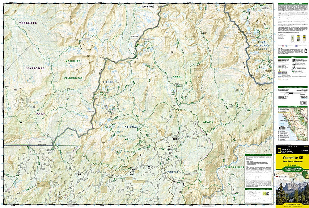
Get ready to hit the trail—Yosemite’s wild beauty is calling! The Yosemite National Park SE Trails Illustrated Topographic Map #309 by National Geographic is your ultimate hiking companion for exploring one of America’s most iconic landscapes. Covering Tuolumne Meadows, the Cathedral Range, and the crystal-clear waters of Thousand Island Lake, this waterproof, tear-resistant map is built for adventure.
Follow in the footsteps of John Muir along sections of the legendary John Muir and Pacific Crest Trails, or soak in sweeping views along the Sierra Vista Scenic Byway. You’ll also find detailed routes to Garnet and Merced Lakes, Moraine Meadows, and Quartz Mountain—each bursting with history, from early Indigenous habitation to the days of the gold rush.
With clearly marked trails, mileage indicators, campgrounds, and GPS-ready UTM grids, this map keeps you confident whether you’re backpacking deep into the Sierra wilderness or enjoying a weekend trek. Adventure-proof, pocket-ready, and hiker-approved!
SKU: SKU:TRA309
View full details