National Geographic
Yellowstone National Park SE Yellowstone Lake Topographic Map #305
Yellowstone National Park SE Yellowstone Lake Topographic Map #305
Couldn't load pickup availability
Share
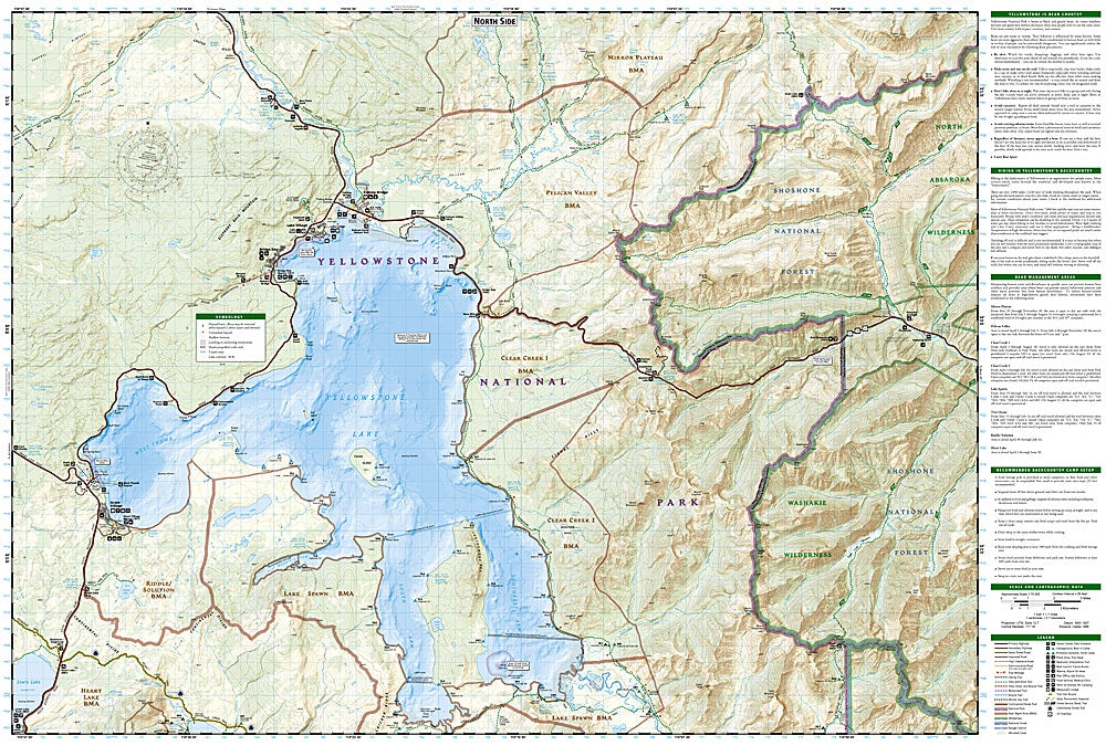
Gear up for adventure with the Yellowstone National Park SE (Yellowstone Lake) Trails Illustrated Topographic Map #305 by National Geographic! Perfect for hikers, paddlers, and backcountry explorers, this map puts you in the heart of one of America’s most iconic parks. Navigate with confidence to Yellowstone Lake, the vibrant West Thumb Geyser Basin, and the breathtaking Storm Point Trail while soaking in the park’s rich history, from its 1872 designation as the nation’s first national park to its geothermal wonders that have fascinated visitors for generations.
Printed on Backcountry Tough waterproof, tear-resistant paper, this map withstands rain, mud, and rugged outdoor conditions. A full UTM grid allows precise GPS navigation so you can chart your route across Yellowstone’s southeastern wonders. Whether trekking forests, spotting wildlife, or exploring geyser basins, this map is your ultimate backcountry companion, blending expert cartography with adventure-ready durability.
SKU: SKU:TRA305
View full details