Benchmark
Wyoming Road & Recreation Atlas by Benchmark Maps
Wyoming Road & Recreation Atlas by Benchmark Maps
Couldn't load pickup availability
Share
Say goodbye to dead zones and spinning signals—this is navigation you can trust anywhere the trail leads! The Wyoming Road & Recreation Atlas by Benchmark Maps is the rugged, hiker-friendly essential that online maps can’t compete with, especially when you’re miles from Wi-Fi and deep in Big Sky Country.
Designed specifically for adventure seekers, this atlas features Benchmark’s unique dual-map format. The “Landscape” pages use elevation-tinted shaded relief to clearly show mountains, valleys, and those hidden backroads that beg for exploring. Bold road labels make it easy to stay on track, even when the wind is howling and your phone battery is on its last breath.
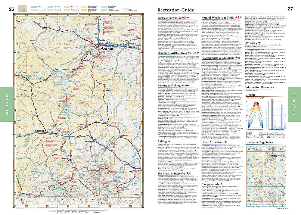
Flip to the “Recreation” section and you’ll find color-coded public land info at a glance—everything from BLM and wilderness areas to National Parks, State Parks, and tribal lands. Looking for campgrounds, boat launches, scenic overlooks, or the perfect fishing spot? It’s all right here. Hunters will appreciate marked mule deer units, while road-trippers love discovering new RV spots, golf courses, and Forest Service offices.
With 96 pages of field-checked maps at 1:250,000 & 1:750,000 scales, this durable 11" x 15" atlas is your ticket to the true heart of Wyoming—where the wild things roam and adventure starts the moment you flip the page.
SKU: SKU:NGSBENWYAT
View full details