National Geographic
World Folded Reference Map with Flags & Facts by National Geographic
World Folded Reference Map with Flags & Facts by National Geographic
Couldn't load pickup availability
Share
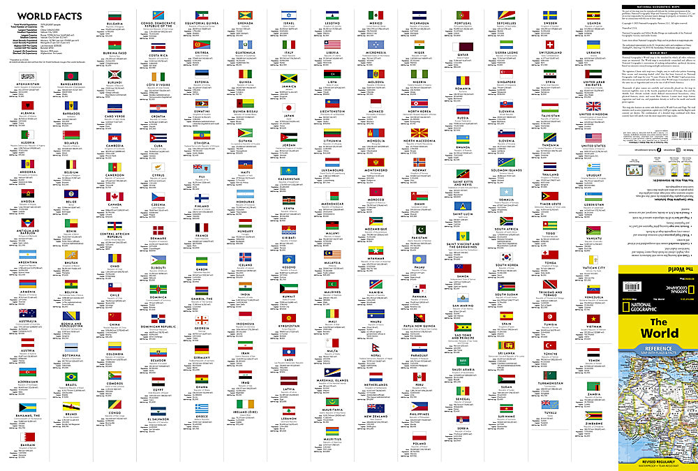
Dream big. Travel bigger. See the entire planet at a glance with the World Folded Reference Map with Flags & Facts by National Geographic, the gold standard world map for explorers, students, and globetrotters alike.
Expertly researched and beautifully designed, this authoritative world reference map is the benchmark by which others are measured. Rendered in the classic National Geographic style, it features brilliant blue oceans, vibrant country borders, and subtle shaded relief that highlights mountain ranges and valleys across every continent. Built using the Winkel Tripel projection, distortions are minimized—so Greenland appears closer in size to Argentina, not an oversized giant.
Up-to-date international boundaries reflect current territorial control, while thousands of clearly placed names ensure cities, islands, airports, rivers, lakes, seas, straits, and even ocean bathymetry are easy to read. Corner inset maps showcase global vegetation, land use, population density, and detailed polar views.
Every country includes its flag and essential stats—area, population, capital, and GDP per capita—making this map as informative as it is eye-catching.
Printed on durable, waterproof, tear-resistant synthetic paper, it’s built for backpacks, classrooms, and coffee tables alike. Wherever curiosity takes you, this world map is ready to unfold.
SKU: SKU:TRA1208
View full details