International Travel Maps
Whistler & Region Travel Map by ITMB
Whistler & Region Travel Map by ITMB
Couldn't load pickup availability
Share
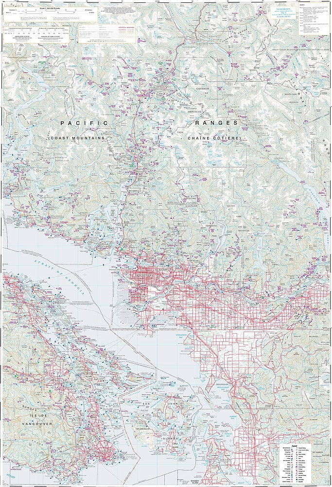
Adventure awaits in British Columbia’s stunning backyard with ITMB’s double-sided Whistler & Region Travel & Reference Map. Whether you're carving fresh powder on Whistler Blackcomb—home to the 2010 Winter Olympics—or biking the newly expanded Whistler Bike Park, this map is your all-season companion.
Side 1 zooms in on Whistler's vibrant alpine playground, including a detailed inset of the Sea to Sky Highway from Vancouver, the bustling village core, ski zones, and trails near Garibaldi Lake, a favorite for hikers chasing turquoise waters and mountain views. You’ll also find a handy Top Attractions list to help prioritize your explorations.
Flip the map and you’re looking at the big picture: an updated topographical view stretching from Vancouver and Victoria to the Sunshine Coast, across the San Juan Islands and up through the Coast Mountains beyond Pemberton. With a scale of 1:50,000 and 1:250,000, this map covers the region with clarity and precision. It’s more than just roads and rivers—it’s a portal to alpine peaks, ferry routes, backroads and parks. At 27" x 39", it folds small but unfolds a vast world of discovery.
SKU: SKU:ITMWhistler
View full details