Kroll Map Company
Whidbey Island Terrain Wall Map
Whidbey Island Terrain Wall Map
Couldn't load pickup availability
Share
This stunning 22" x 36" Whidbey Island Map is a decorative marvel that beautifully captures the essence of Whidbey Island and its surrounding areas. This intricately designed map boasts a blend of form and function, making it a must-have for both enthusiasts of cartography and admirers of exquisite home decor.
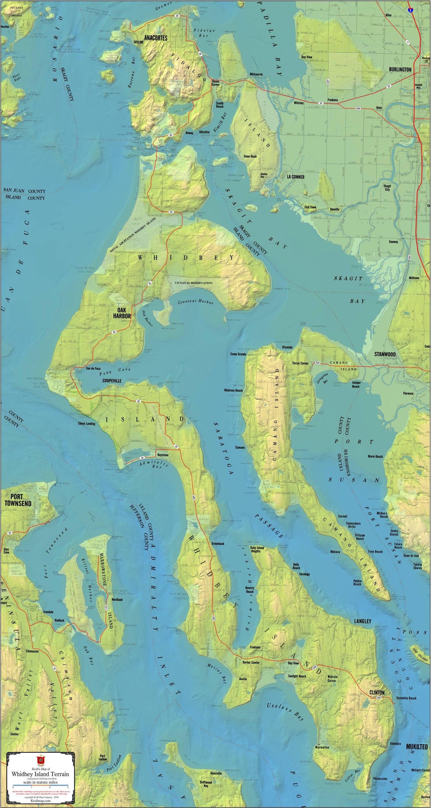
The Whidbey Island Map showcases the island's intricate geography, featuring place names, major roads, and shaded relief that vividly depicts both land and water terrain. Every contour and elevation is meticulously crafted to provide a true-to-life representation of Whidbey Island and its neighboring regions, including Camano Island and Port Townsend.
This Whidbey Island Map is available in two distinct options to suit your preference: printed on high-quality paper or laminated for added durability and longevity. Choose the paper option if you prefer a classic and elegant look, perfect for framing and displaying as a focal point in your home or office. Opt for the laminated version if you desire a more resilient map that can withstand the test of time, all while retaining its vibrant colors and sharp details.
Whether you're a seasoned cartography aficionado or simply looking to add a touch of beauty to your living space, the Whidbey Island Map is an absolute gem. Its versatility in design and exceptional craftsmanship make it a perfect gift for geography enthusiasts, nature lovers, or anyone with an appreciation for the beauty of Whidbey Island and its neighboring regions.
SKU: SKU:KROWHIT
View full details