Basin and Range Mapping
Washington's Northwest Cascades Wall Map
Washington's Northwest Cascades Wall Map
Couldn't load pickup availability
Share
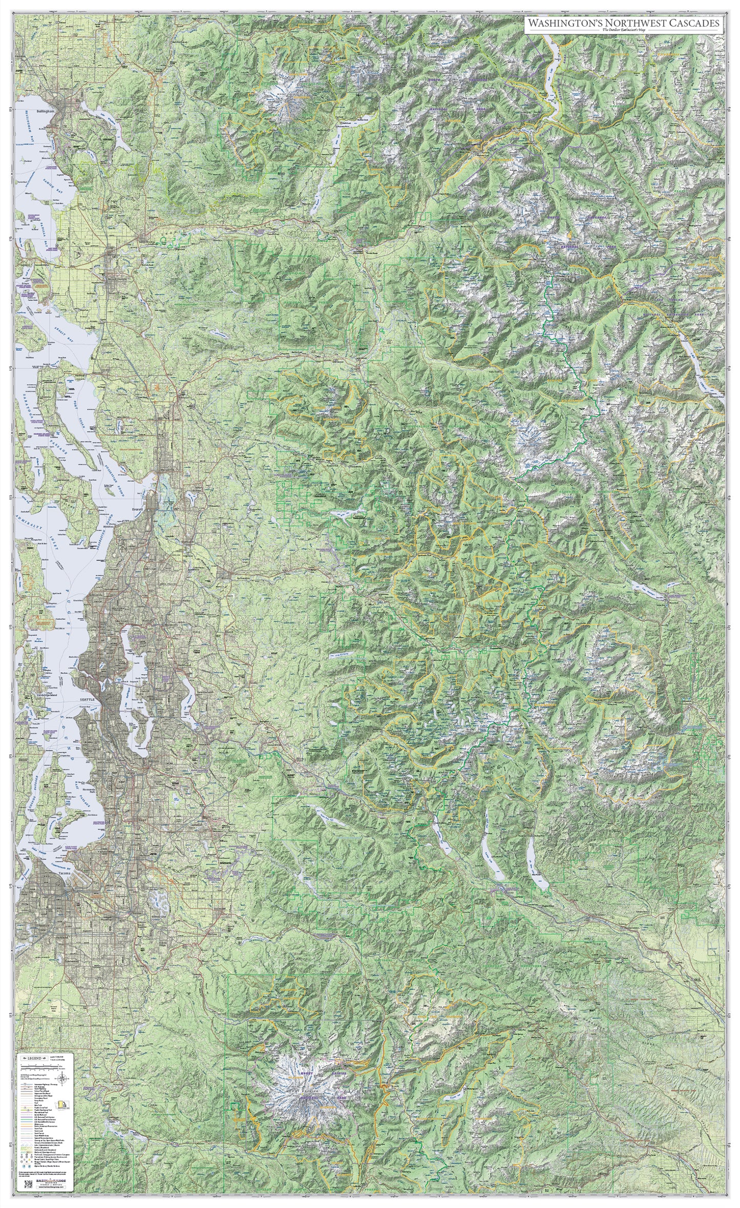
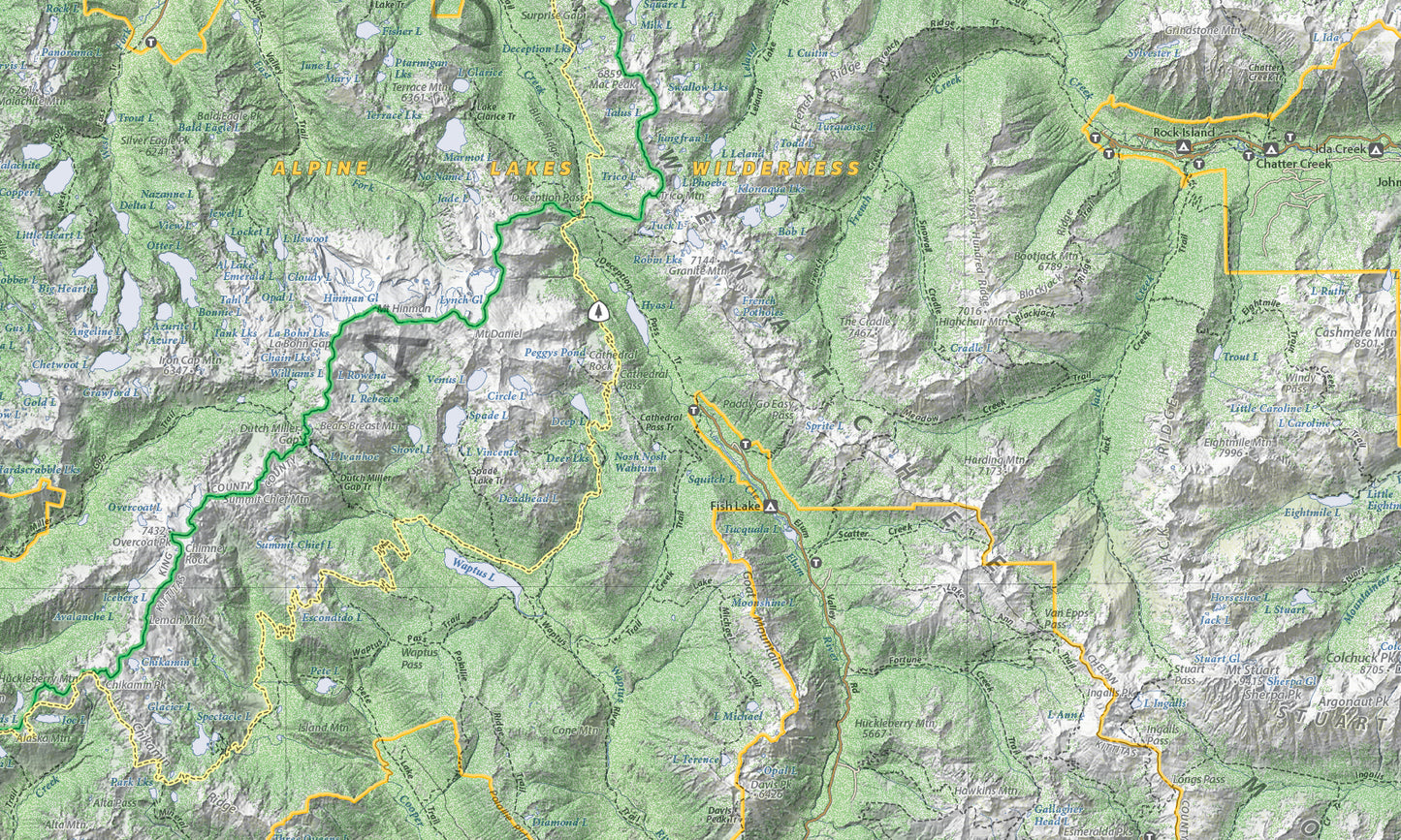
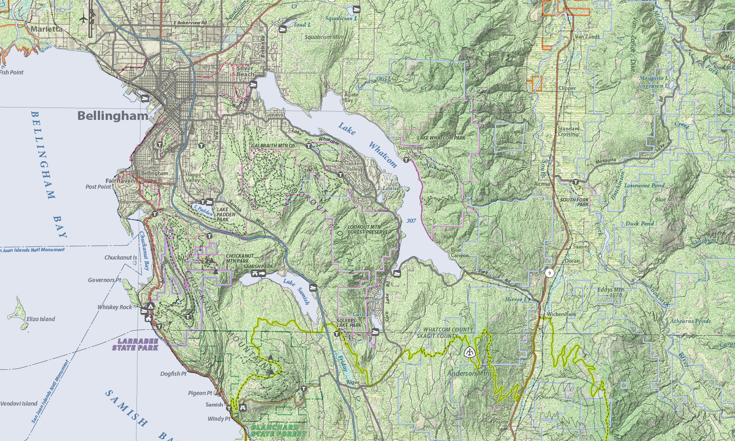
This map covers Washington State's Northwest Cascade Mountains from the Canadian border to Mount Rainier National Park, Including North Cascades National Park and the greater Seattle area.
Every recreational site and area is shown: trailheads, picnic areas, campgrounds, fishing access sites, boat launch sites, and ski areas.
The map is designed to have two different perspectives. From a distance the viewer sees only the landscape and major highways. But viewed close up the viewer sees thousands of individual items (named peaks, creeks, recreation sites, forest service roads, trails, etc.) not seen from a distance.
To give the map a three dimensional look, it uses hypsometric elevation coloring combined with shaded relief and six types of land cover: forest, sagebrush, cropland, grassland, wetland, and urban areas.
Size: 38" x 62"
Scale: 1:165,000
SKU: SKU:BRMWANWCAS
View full details