Mitchell Geography
Washington Wilderness Reference Map / Poster
Washington Wilderness Reference Map / Poster
Couldn't load pickup availability
Share
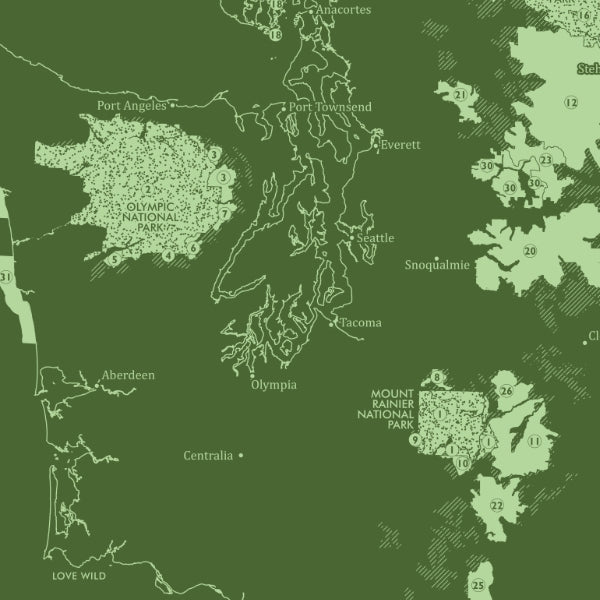
Escape the noise and rediscover the wild beauty of the Pacific Northwest with this stunning Washington Wilderness Reference Map / Poster! Bursting with vintage-inspired style and rich geographic detail, this eye-catching green monochrome print transforms any wall into an adventure hub for hikers, campers, explorers, and map lovers alike.
Printed on heavy fine paper in a bold 13" x 19" format, this Washington State wilderness map highlights National Parks, National Wilderness System lands, U.S. Forest Service Inventoried Roadless Areas, and the remote coastal San Juan and Washington Islands wilderness regions. From the glacier-capped majesty of Mount Rainier to the rugged rainforests of Olympic National Park, every detail sparks memories of epic road trips and future outdoor escapes.
The included acreage legend showcases all federally designated wilderness areas across the state, reflecting decades of conservation history that helped preserve Washington’s legendary landscapes. Fun fact: Washington is home to the largest glacier system in the contiguous United States outside Alaska. A striking souvenir, reference tool, and conversation-starting art print all in one!
SKU: SKU:PMGWAWG01
View full details