National Geographic
Washington State Wall Map by National Geographic
Washington State Wall Map by National Geographic
Couldn't load pickup availability
Share
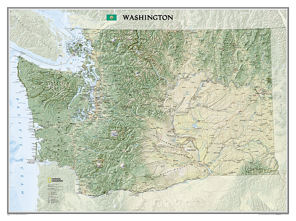
Discover the natural beauty and geographic diversity of the Evergreen State with the Washington State Wall Map by National Geographic. This stunning 41" x 30" wall map showcases Washington’s landscapes in vibrant detail, from the forested San Juan Islands and rugged Olympic Peninsula to the snow-capped peaks of Mount Rainier, Mount Baker, and the Cascade Range. Shaded relief and rich colorization bring to life the rivers, valleys, and rolling agricultural basins shaped by the Columbia and Snake Rivers.
Perfect for home, office, or classroom display, this map highlights major cities and towns, highways, airports, state and national parks, and military bases. Outdoor enthusiasts will appreciate the inclusion of the Pacific Crest Trail, which stretches across the state from Canada to Oregon. Available in paper or laminated options, the Washington State Wall Map is both educational and visually captivating, making it an ideal reference and décor piece for anyone who loves Washington.
SKU: SKU:NGSWAP
View full details