Rand McNally
Washington State Highway Folded Map by Rand McNally - Easy to Read
Washington State Highway Folded Map by Rand McNally - Easy to Read
Couldn't load pickup availability
Share
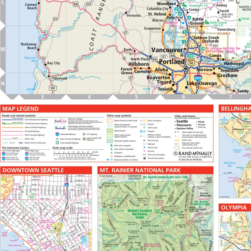
Hit the open road in the Evergreen State with Rand McNally’s Washington State Easy to Read Folded Highway Map — your paper-powered passport to discovery! Ditch the signal drop and screen glare; this full-color, regularly updated map keeps your adventure on track wherever Wi-Fi dares not wander.
Navigate every curve of Washington’s scenic highways with clear labeling for Interstates, U.S., state, and county routes — plus parks, airports, and can’t-miss points of interest. The larger print and easy-to-use legend make trip planning simple, whether you’re cruising the Cascade Loop or exploring hidden gems like Palouse Falls, one of the state’s most spectacular (and lesser-known) natural wonders.
With mileage charts, driving times, and a detailed index, this trusty companion is as reliable as it is road-trip ready. Affordable, accurate, and adventure-approved — the Washington Easy to Read Folded Map is your go-anywhere guide to the Evergreen State!
SKU: SKU:RMCUSWA
View full details