Muir Way
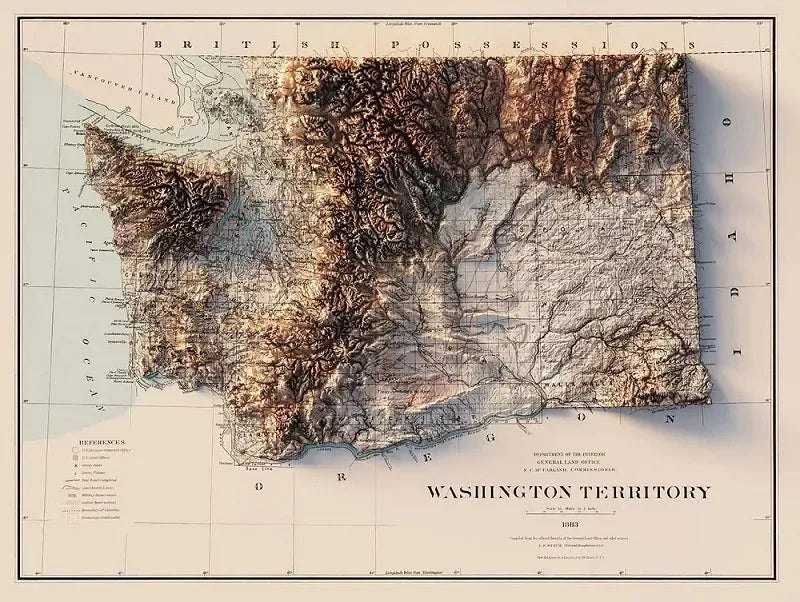
Washington 1883 Relief Map
Washington 1883 Relief Map
Couldn't load pickup availability
Share
Created by Muir Way - This 24" x 18" Vintage Style Wall Map of Washington State was originally drawn in 1883 (before we even became a state! so this is techincally the Washington Territory..?) and has been combined with Digital Elevation Data to give this map a unique appearance.
While this map looks exactly as a 3D Raised Relief Map would, it's actually flat (we know, we were shocked at how much it looked like a 3D map too.) and much easier to frame than the old school raised relief maps.
Each Muir Way map is printed on top quality archival paper / ink and always custom printed to order. They also say their maps have a warranty of 100 years - we'll have to take their word for it!
SKU: SKU:MUIWA1883R
View full details