Red Maps
Vienna City Center Street Map by Red Maps
Vienna City Center Street Map by Red Maps
Couldn't load pickup availability
Share
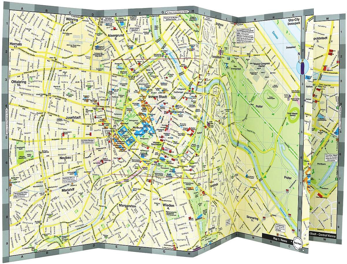
Slip this vibrant Vienna City Center Street Map into your pocket and step into a city where old-world charm meets modern elegance. This laminated, easy-to-read guide from Red Maps highlights all the essentials—whether you're wandering the cobbled streets of the Innere Stadt or hopping the tram to the lush expanse of the Prater.
Discover where to find Klimt’s shimmering masterpieces, which boutiques are worth a detour, and how to reach the imperial grandeur of Schönbrunn Palace and Gardens. Metro and tram lines are clearly marked, so you won’t miss a beat—or a Beethoven. From world-class museums and royal palaces to cozy cafés and chic hotels, this colorful map is your key to exploring Vienna’s most captivating neighborhoods including Josefstadt, Mariahilf, and Leopoldstadt.
Whether you’re chasing history or Sachertorte, this map keeps Vienna’s magic at your fingertips. Let the music and charm of the city lead the way.
SKU: SKU:REDVIENNA
View full details