1
/
of
1
National Geographic
Utah State Wall Map by National Geographic
Utah State Wall Map by National Geographic
Regular price
$34.95 USD
Regular price
Sale price
$34.95 USD
Unit price
/
per
Couldn't load pickup availability
Share
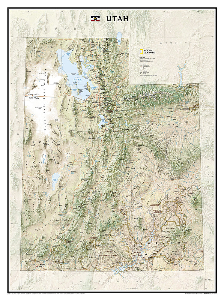
Discover the beauty and geographic diversity of Utah with the National Geographic Utah State Wall Map, a stunning reference and display piece for home, office, or classroom.
This richly detailed 41" x 30" map captures the state’s dramatic landscapes, from the Bonneville Salt Flats and the vast Great Salt Lake to the rugged Uinta Mountains and the world-famous red rock canyons of the Colorado Plateau. Featuring shaded relief and vivid color, the map highlights mountain ranges, deserts, forests, lakes, rivers, and reservoirs with unmatched clarity. It includes hundreds of place names along with the locations of cities, highways, railways, airports, military bases, and Utah’s treasured national and state parks.
Perfect for educators, travelers, and outdoor enthusiasts, this Utah wall map provides both practical information and striking visual appeal. Part of National Geographic’s acclaimed State Wall Map series, it’s an essential addition for anyone who loves the American West.
SKU: SKU:NGSUTP
View full details