The MapShop
USA Raised Relief Map - Rand McNally Map Version
USA Raised Relief Map - Rand McNally Map Version
Couldn't load pickup availability
Share
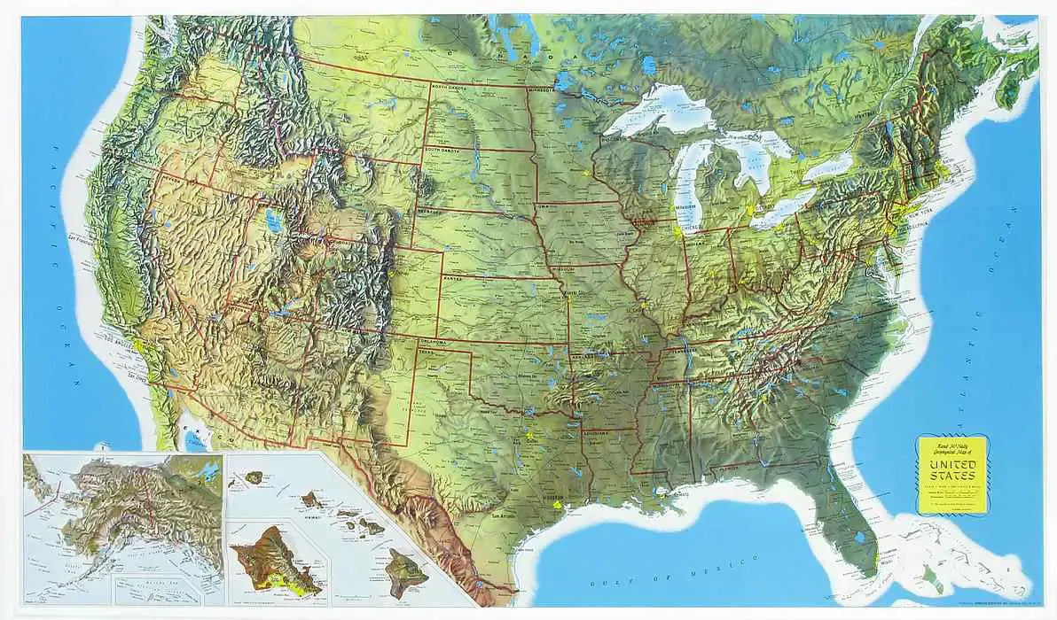
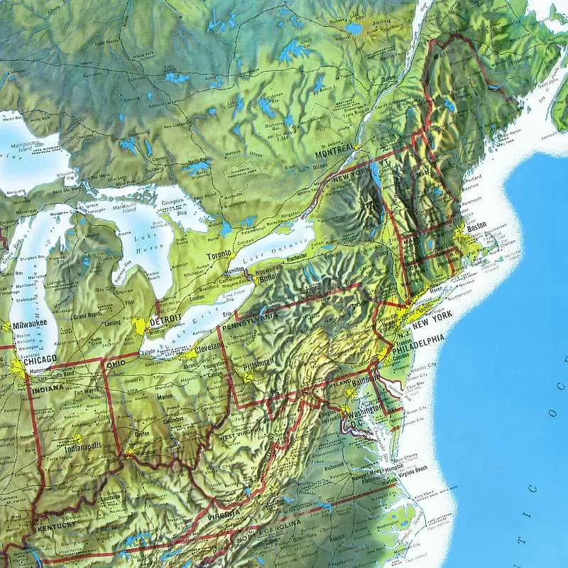
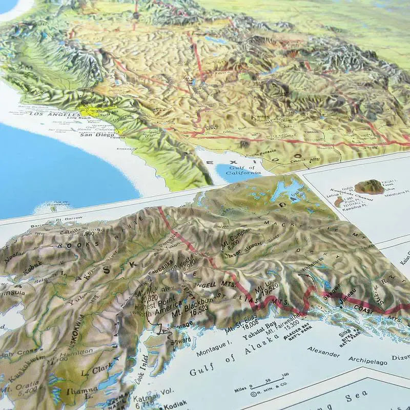
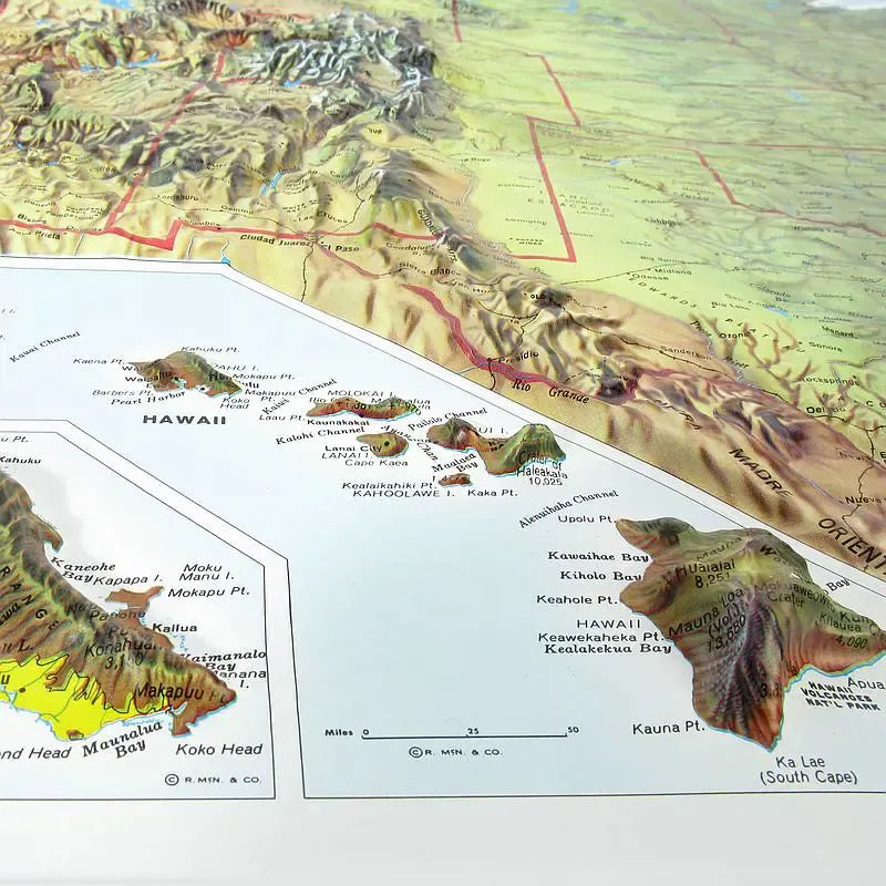
United States Raised Relief Map (Rand): Discover the beauty and topography of the United States like never before with this stunning Raised Relief Map. Crafted from molded plastic and based on the Rand McNally Geographic Map, this map brings the diverse landscapes of the country to life. With detailed labeling of states, cities, towns, and other landmarks, it’s perfect for students, educators, and geography enthusiasts alike. The state borders are prominently featured in red, making it easy to navigate and explore each region. Alaska and Hawaii are thoughtfully included as insets, maintaining a comprehensive view of the entire nation.
United States Raised Relief Map (Rand) Geographic Features: Beyond the peaks, this map beautifully captures the varied geographical features that define the United States. From the sweeping plains of the Midwest to the undulating hills of the South, each region’s unique landscape is displayed with tactile accuracy. The expansive Great Basin, the arid deserts of the Southwest, the lush valleys of California, and the vast, fertile Mississippi River basin are all featured. The map also details significant bodies of water, including the Great Lakes, the mighty Mississippi River, and the extensive coastline along both the Atlantic and Pacific Oceans.
** Raised Relief Maps are printed on vinyl and are not intended to roll and/or fold. We ship them in a flat box and pack them with love (i.e. Plenty of bubble wrap!) **
SKU: SKU:TMSUSARAND
View full details