The MapShop
USA Raised Relief Map
USA Raised Relief Map
Couldn't load pickup availability
Share
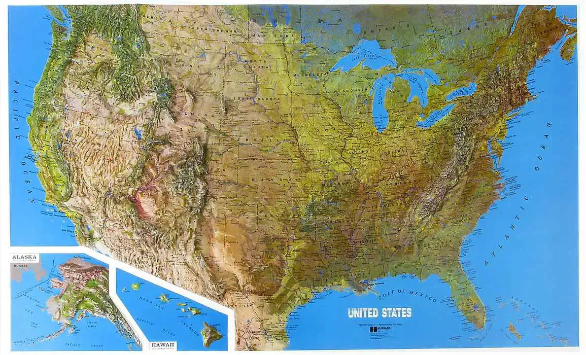
USA Raised Relief Map: Discover the beauty and diversity of the United States' landscape with this stunning Raised Relief Map. Perfect for educators, students, or geography enthusiasts, this meticulously crafted map offers a tactile experience, showcasing the nation's varied topography in vivid detail. Molded from durable plastic and designed with a scale of 1" = approximately 100 miles, this map provides an interactive and educational way to explore the country’s geographical features.
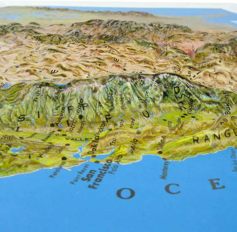
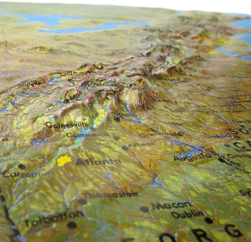
USA Raised Relief Map Peaks & Ranges: This Raised Relief Map prominently displays the majestic mountain ranges that define America's landscape. The towering Rocky Mountains stretch across the western United States, with notable peaks like Mount Elbert in Colorado standing tall. To the east, the Appalachian Mountains are depicted in their full, winding glory, showcasing peaks like Mount Mitchell, the highest point east of the Mississippi River. The Sierra Nevada range is also beautifully highlighted, with Mount Whitney—the highest peak in the contiguous United States—standing out as a must-see feature. These peaks and ranges are not just marked; they are brought to life through the map's raised design, offering a tangible representation of their grandeur.
USA Raised Relief Map Geographic Features: Beyond the peaks and ranges, this map captures a wide array of geographic features that make the United States unique. The Great Plains are shown in their expansive, flat simplicity, contrasting sharply with the rugged terrain of the western mountains. The Colorado Plateau and the dramatic depths of the Grand Canyon are clearly defined, offering a glimpse into the earth’s geological history. The coastal plains along the Atlantic and Gulf coasts, the vast Mississippi River Basin, and the rolling hills of the Midwest are all represented, providing a comprehensive view of the nation's diverse landscapes. Major cities, towns, and other landmarks are labeled, making this map not only a geographic tool but also a cultural guide.
Size: 34" x 22"