National Geographic
United States Folded Reference Map with Flags by National Geographic
United States Folded Reference Map with Flags by National Geographic
Couldn't load pickup availability
Share
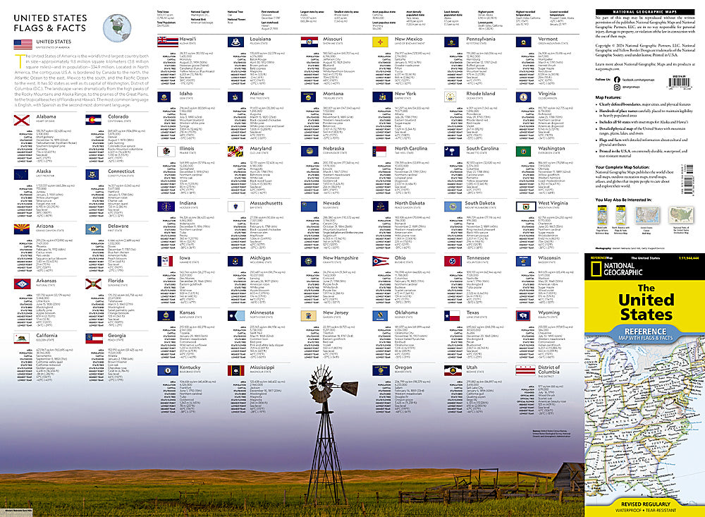
See the whole country at a glance—and take it anywhere you go. The United States Folded Reference Map with Flags by National Geographic turns geography into an adventure you can unfold on your kitchen table or pack in your carry-on.
Expertly researched and beautifully designed, this authoritative reference map showcases both a detailed political map and a vivid physical map of the nation. Clearly defined state boundaries, major cities, and hundreds of carefully placed place names make it easy to explore everything from the towering Rocky Mountains to the winding Mississippi River. The physical map highlights mountain ranges, plains, lakes, and rivers, while the political side maps cities and key landmarks across the United States, plus adjacent regions of Canada and Mexico.
What makes this map truly stand out? A colorful collection of state flags paired with fascinating facts about the cultural and physical features that define each state—perfect for students, travelers, and trivia lovers alike.
Printed in the U.S.A. on durable synthetic paper, this waterproof and tear-resistant folded map is built to handle road trips, classrooms, and cross-country adventures with ease.
SKU: SKU:TRA1209
View full details