International Travel Maps
Uganda Travel & Reference Map by ITMB
Uganda Travel & Reference Map by ITMB
Couldn't load pickup availability
Share
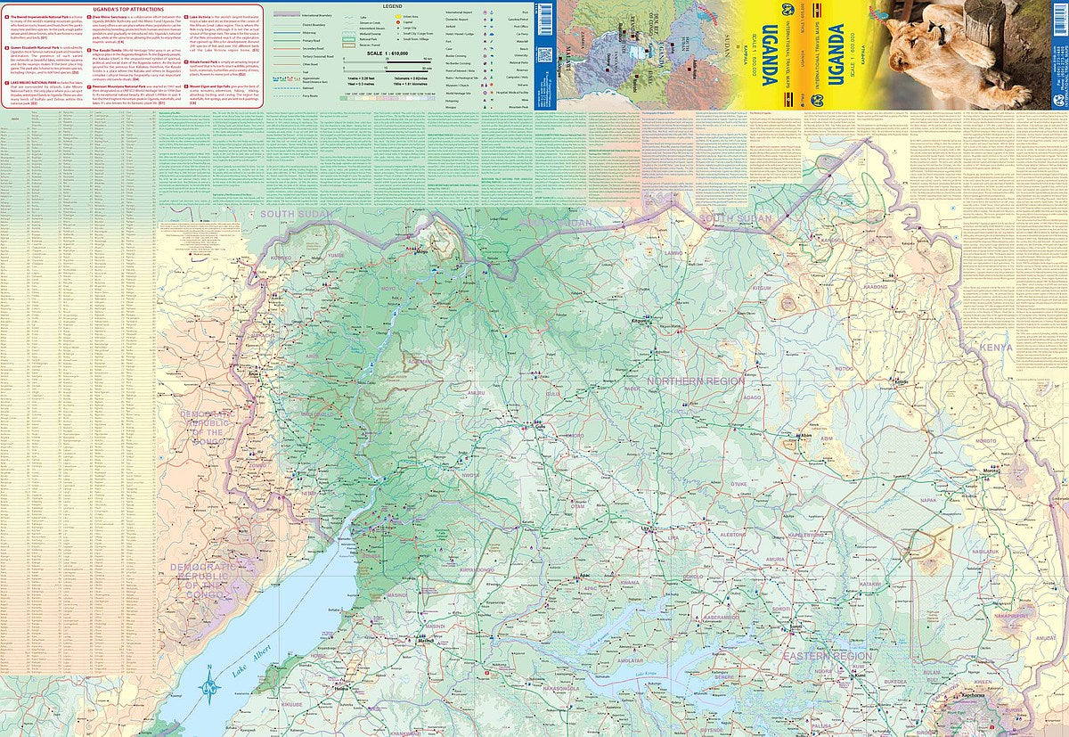
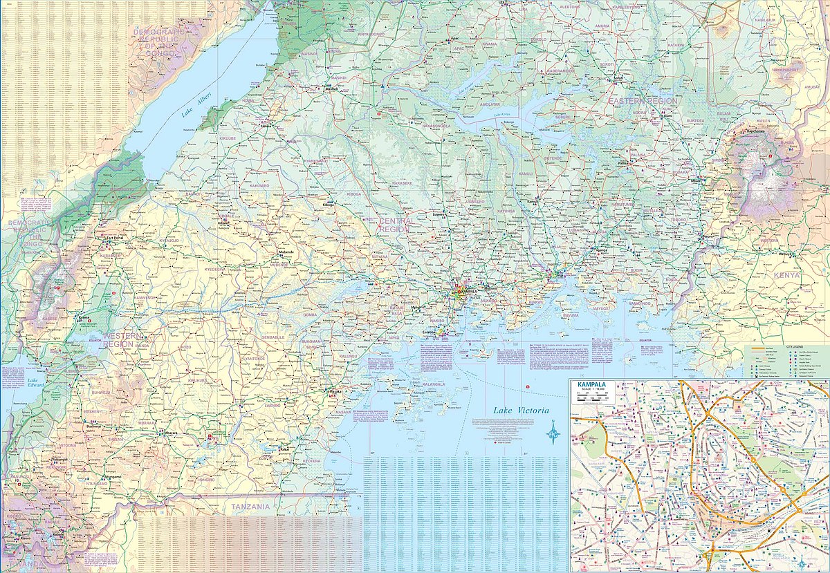
Discover one of Africa’s most captivating destinations with ITMB’s folded, double-sided Uganda Travel & Reference Map at 1:600,000 scale. This detailed and easy-to-use map offers full coverage of the country's top tourist areas and natural wonders.
Side 1 highlights northern Uganda, featuring Murchison Falls National Park—famous for powerful waterfalls and abundant wildlife—along with remote and rugged Kidepo National Park, ideal for those seeking off-the-beaten-path adventure. Eastern Uganda’s Mount Elgon adds volcanic drama to the landscape.
Flip to Side 2 for a look at southern Uganda, where Kampala pulses with culture and history as the capital and center of Bugandan heritage. Lake Victoria, Africa’s largest lake, stretches along the southern border and offers endless exploration opportunities.
This map includes clearly classified roads, rivers, lakes, parks, airports, and key points of interest. Perfect for travelers, researchers, or armchair explorers, this 27" x 39" map is your gateway to discovering Uganda's diverse beauty.
SKU: SKU:ITMUGA
View full details