National Geographic
Tour du Mont Blanc Great Treks Topographic Map Guide by Nat Geo #4010
Tour du Mont Blanc Great Treks Topographic Map Guide by Nat Geo #4010
Couldn't load pickup availability
Share
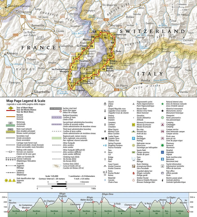
Take on one of the world's most legendary hikes with confidence! The Tour du Mont Blanc Great Treks Topographic Map Guide by National Geographic is your ultimate trail companion, helping you navigate every breathtaking step of this unforgettable alpine adventure.
Following the iconic 170-kilometer Tour du Mont Blanc, this detailed topographic map guide leads hikers through France, Switzerland, and Italy as they circle the magnificent Mont Blanc Massif—the highest peak in Europe at 15,774 feet. Wander through charming mountain villages, colorful alpine meadows, dramatic glacier valleys, rugged rocky landscapes, and welcoming mountain refuges while soaking in some of the most spectacular scenery on Earth.
Each trail section includes clear topographic mapping and detailed route descriptions highlighting important landmarks, making it easy to stay on course during the 10 to 12-day trek. Whether you're planning your first TMB adventure or returning for another unforgettable journey, this guide is designed to keep you informed every step of the way.
Printed on National Geographic's durable synthetic paper, this waterproof, tear-resistant map guide is built to handle rain, mud, backpacks, and every unforgettable mile of your alpine adventure.
SKU: SKU:TRA4010
View full details