Hedberg Maps
The Titanic Reference Map
The Titanic Reference Map
Couldn't load pickup availability
Share
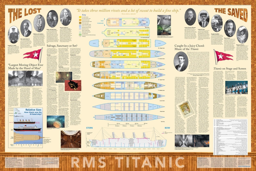
The Titanic Reference Map brings the legendary story of the world’s most infamous ocean liner to life through a vivid geographic lens. Perfect for history lovers, map enthusiasts, and collectors, this folded paper map turns the Titanic’s tragic journey into an unforgettable visual experience. One side traces the ship’s transatlantic route alongside the path of the fatal iceberg, highlighting how the disaster reshaped global shipping lanes and ushered in modern iceberg patrols. Flip it over to explore a detailed geographic breakdown of the ship itself, revealing key sections, engineering marvels, and the cultural legacy that continues to fascinate more than a century later.
Updated in its fourth edition (old cover picture), this award-winning map blends rich storytelling with precise cartography. At a full unfolded size of 39"w x 27"h, it offers impressive detail, yet folds neatly to 5.6"w x 9"h for easy storage and display. Ideal for classrooms, home libraries, or Titanic fans everywhere.
ArticlesSKU: SKU:HEDTITANIC
View full details