International Travel Maps
Tahiti & French Polynesia Travel & Reference Map by ITMB
Tahiti & French Polynesia Travel & Reference Map by ITMB
Couldn't load pickup availability
Share
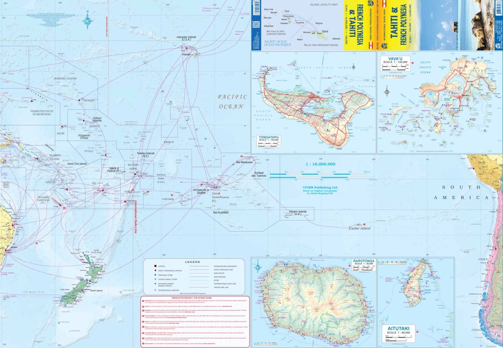
The Tahiti & French Polynesia Travel & Reference Map by ITMB brings the dream of the South Pacific right into your hands. Designed for cruisers, island-hoppers, and sun-seekers, this double-sided folded map highlights why this tropical archipelago remains one of the world’s most irresistible destinations. With scales of 1:100,000 and 1:16,000,000, it clearly displays the Society Islands, including favorites like Tahiti, Moorea, and Bora Bora, along with the serene beauty of Raiatea.
Side One shows the islands’ position in the vast Pacific Ocean relative to Hawaii, Pitcairn, Samoa, and New Zealand, while offering detailed maps of Rarotonga, Aitutaki, and Vava’u. Flip it over and you’ll find Side Two packed with detailed maps of a dozen islands plus an inset of Papeete, the vibrant capital known for its waterfront and lively markets. Travelers will love the Top Attractions list and the comprehensive hotel and resort index, making trip planning effortless.
Legend highlights include roads by classification, national parks, rivers, lakes, airports, highways, main roads, and countless points of interest. Folded for convenience and sized at 27" x 39", it’s the perfect companion for your next island escape.
SKU: SKU:ITMTAHITI
View full details