SeaTrails
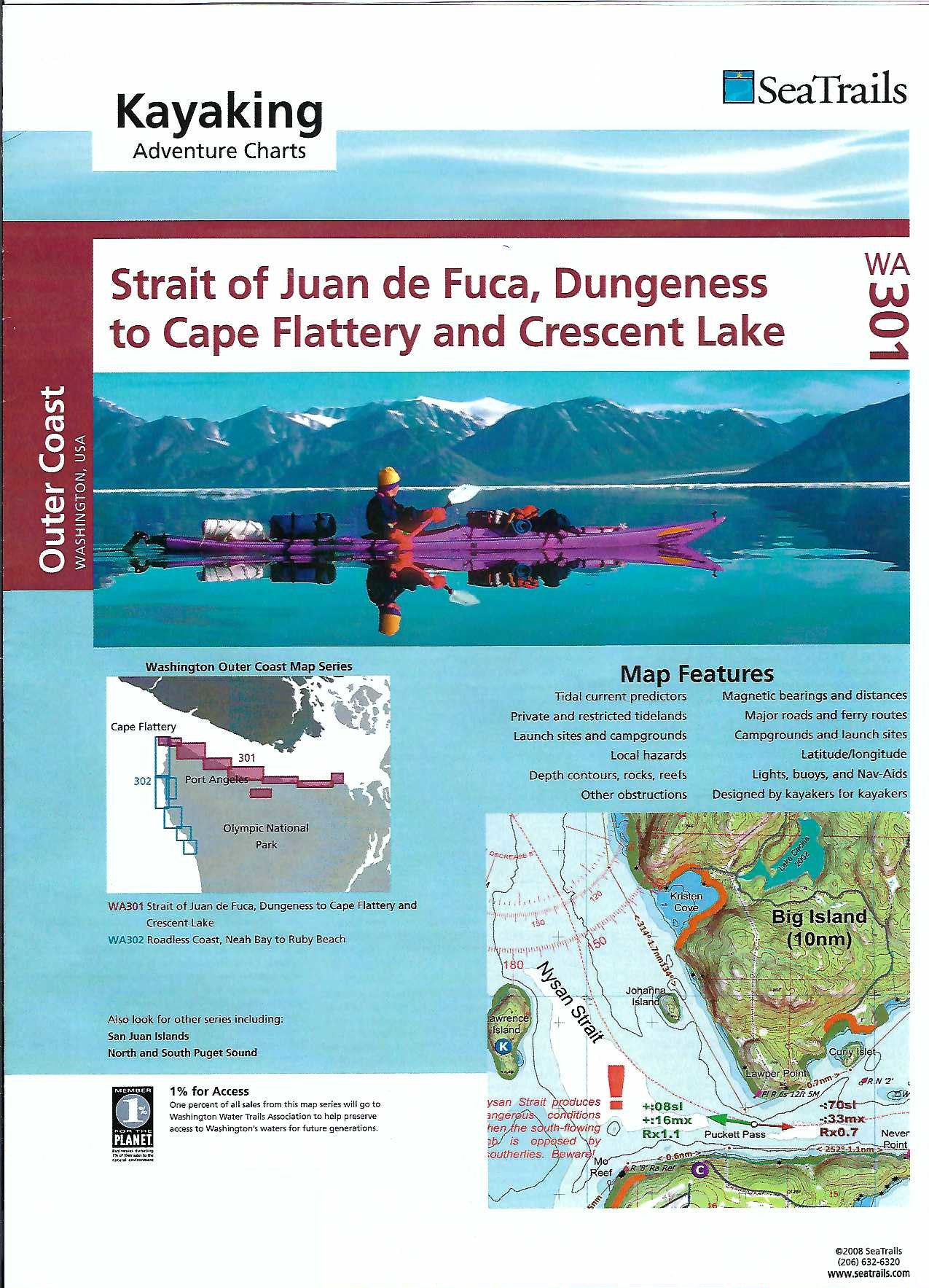
Straight of Juan de Fuca & Crescent Lake Paddling Map WA301
Straight of Juan de Fuca & Crescent Lake Paddling Map WA301
Couldn't load pickup availability
Share
Explore the wild beauty of the Pacific Northwest with the Strait of Juan de Fuca & Crescent Lake Kayaking Adventure Chart by SeaTrails. This waterproof, compact paddling map is designed just for sea kayakers and is packed with essential info like launch points, campgrounds, paddling hazards, and more.
Paddle past the scenic shores of Salt Creek Recreation Area, discover the pristine waters of Crescent Lake, or spot marine life near Dungeness Spit. The chart includes navigational aids, buoy locations, and shoreline distances with bearings to make trip planning a breeze.
Its durable design fits perfectly on your kayak deck, ready for any adventure. Whether you're exploring coastal reefs or charting a new course across open water, this map helps you paddle smart and explore farther.
SKU: SKU:SEAWA301
View full details