Custom Correct
South Olympic Coast Trail Map
South Olympic Coast Trail Map
Couldn't load pickup availability
Share
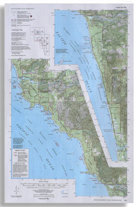
The South Olympic Coast Trail Map by Custom Correct offers an invaluable resource for exploring the stunning southern half of Olympic National Park’s coastal wilderness.
Stretching from just north of La Push and the Quillayute River to the Queets River in the south, this map captures the full beauty of Washington’s rugged Pacific coastline. It also highlights the Kalaloch section of Highway 101, as well as the Quileute and Hoh Reservations, providing a comprehensive view of the region.
With a scale of 1:62,500 and a 40-foot contour interval, this detailed map is perfect for hikers, campers, and outdoor enthusiasts looking to navigate the breathtaking terrain of one of America’s most pristine national parks.
SKU: SKU:LRESOC
View full details


