

SeaTrails
South Hood Canal & Dabob Bay Paddling Map WA201
South Hood Canal & Dabob Bay Paddling Map WA201
Couldn't load pickup availability
Share
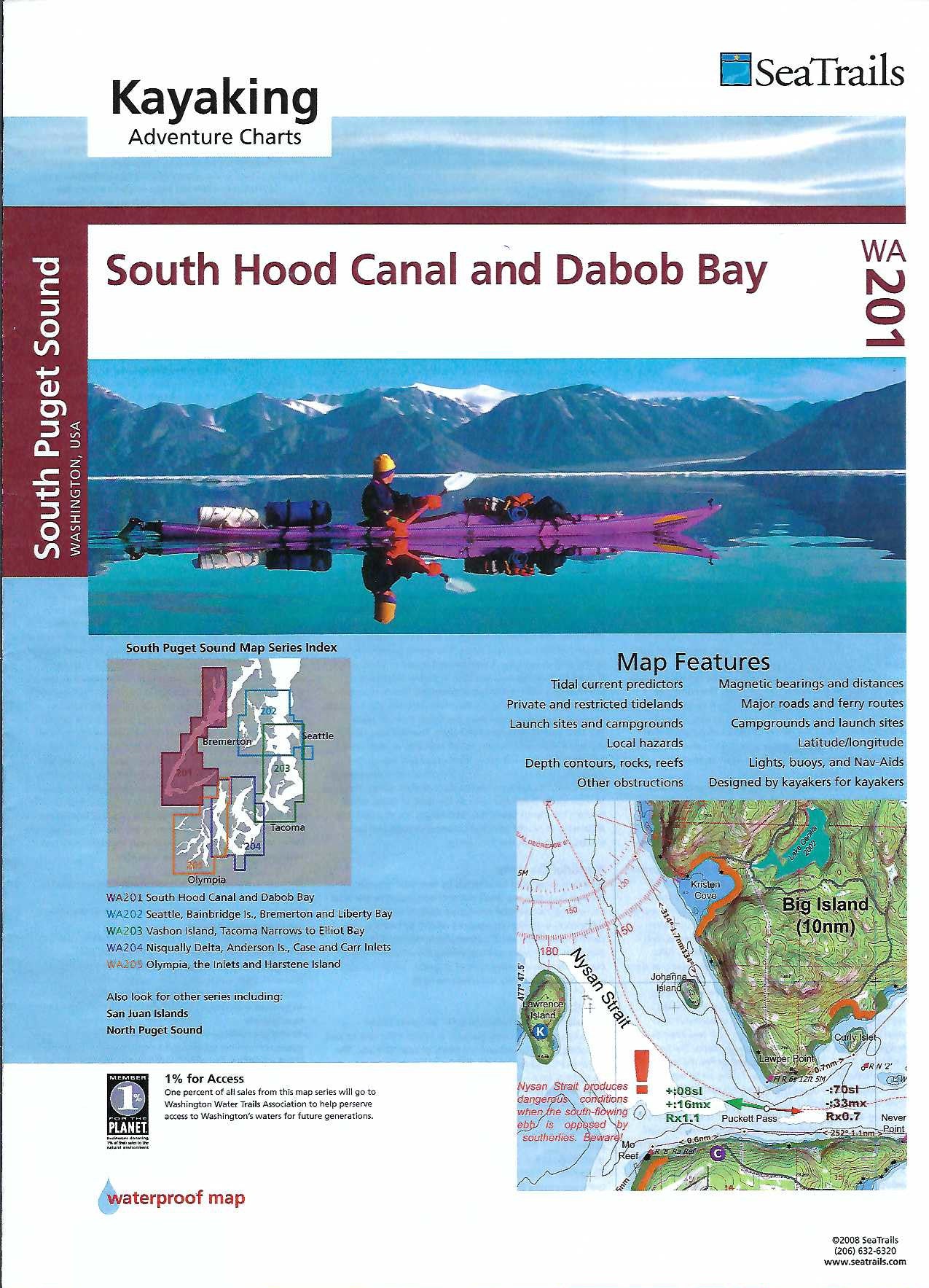
Discover the wild beauty of Washington’s inland waters with the South Hood Canal & Dabob Bay Kayaking Adventure Chart by SeaTrails. Perfect for sea kayakers, this waterproof, deck-friendly map guides you through scenic spots like the clear waters of Pleasant Harbor, the lush shoreline near Dosewallips State Park, and the hidden coves of Dabob Bay.
SeaTrails Charts are designed with paddlers in mind, featuring public launch points, campsites, navigational aids, paddling hazards, and more. Light and buoy locations, rocks, reefs, and depth contours keep you safe, while shoreline distances and bearings help you plan every leg of your journey.
Whether you're exploring for a day or charting a multi-day adventure, this chart is your trusted guide to the tidal magic of Hood Canal.
SKU: SKU:SEAWA201
View full details