National Geographic
South America & Antarctica Folded Reference Map by National Geographic
South America & Antarctica Folded Reference Map by National Geographic
Couldn't load pickup availability
Share
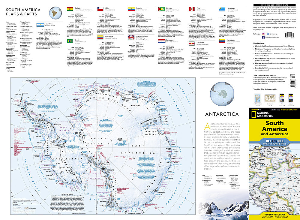
Dream bigger. Travel farther. Explore two continents at once with the South America & Antarctica Folded Reference Map with Flags by National Geographic.
Built for curious travelers and globe-trotters alike, this expertly researched reference map delivers a vibrant, easy-to-read political map of South America paired with a detailed physical map showcasing the continent’s dramatic landscapes—from the towering Andes Mountains to the winding Amazon River. Clearly defined country boundaries, major cities, and hundreds of carefully placed names make trip planning effortless, whether you’re charting a trek to Machu Picchu or mapping out a Patagonia adventure.
Flip it over and discover a combined political and physical map of Antarctica, complete with flags and fascinating facts about the southernmost continent. It’s the perfect blend of geography and culture in one compact, travel-ready design.
Printed in the U.S.A. on durable synthetic paper, this waterproof and tear-resistant folded map is built to handle rain, backpacks, and repeat adventures. Whether you’re planning, dreaming, or actively exploring, this South America and Antarctica reference map belongs in every traveler’s collection.
SKU: SKU:TRA1234
View full details