National Geographic
South Africa Wall Map by National Geographic
South Africa Wall Map by National Geographic
Couldn't load pickup availability
Share
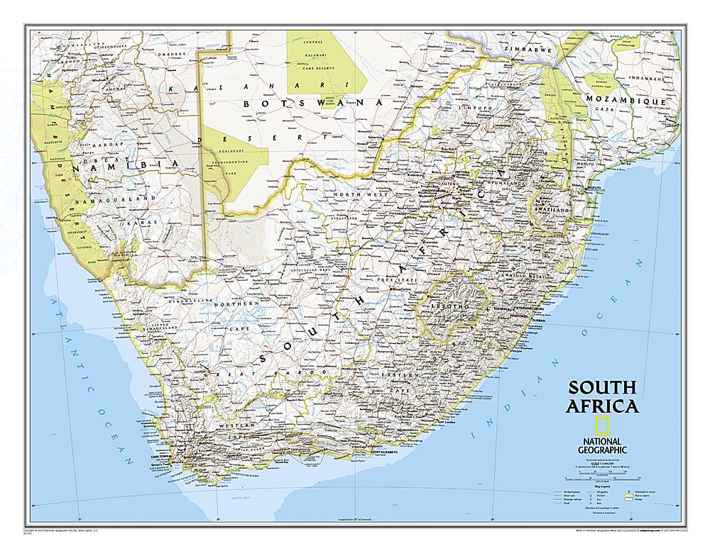
Get ready to explore South Africa from your wall with National Geographic’s stunning South Africa Wall Map! Perfect for travelers, adventurers, and armchair explorers, this map brings the country’s nine provinces—and its neighboring nations of Namibia, Botswana, Zimbabwe, Mozambique, Swaziland, and Lesotho—into vibrant focus. Track your safari dreams across iconic national parks, spot the majestic wildlife of Kruger, Addo Elephant, and Kgalagadi, or plan your next city adventure in Cape Town, Johannesburg, or Durban.
Featuring local place names that celebrate South Africa’s rich cultural diversity, the map highlights mountains, deserts, salt pans, and swamps with expertly shaded relief. Detailed roads, highways, railways, and airports make navigation a breeze. National Geographic’s signature Classic style ensures bright, easy-to-read colors and timeless cartographic elegance. Measuring 30.25" x 23.5", this map is a gorgeous centerpiece and a must-have for anyone inspired by South Africa’s landscapes, wildlife, and vibrant culture.
SKU: SKU:NGSSOA
View full details