International Travel Maps
Senegal & Gambia Travel & Reference Map by ITMB
Senegal & Gambia Travel & Reference Map by ITMB
Couldn't load pickup availability
Share
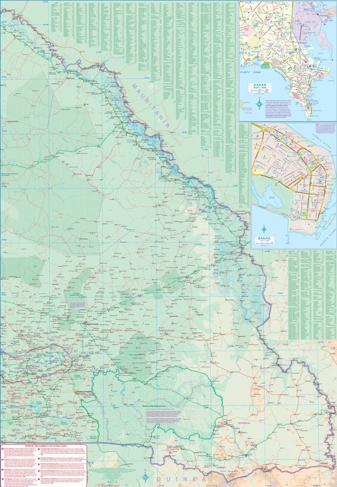
The Senegal & Gambia Travel & Reference Map by ITMB (scale 1:500,000) brings two of West Africa’s most fascinating countries to life in a highly usable double-sided, folded format perfect for planning and on-the-ground exploring. One side highlights western Senegal and Gambia, including Dakar, one of the world’s great natural harbors and the historic hub of French West Africa. The reverse covers the eastern regions, where travelers can trace routes toward destinations like the Niokolo-Koba National Park and the inland rail corridor that once stretched toward Tambacounda.
This map provides geographic context for the area’s dramatic past, from the creation of Gambia’s unusual borders—shaped by British artillery range—to the deeply moving Ile de Goree, now a powerful memorial to the transatlantic slave trade. Visitors can also pinpoint coastal resort areas along the Atlantic, journey to iconic nature hotspots like River Gambia National Park, and navigate roads that range from smooth highways to variable rural tracks.
With clear classifications for roads, rivers, lakes, airports, national parks, and key points of interest, this 27" x 39" map is an essential companion for travelers seeking a deeper understanding of Senegal and Gambia.
SKU: SKU:ITMSEN
View full details