NOAA
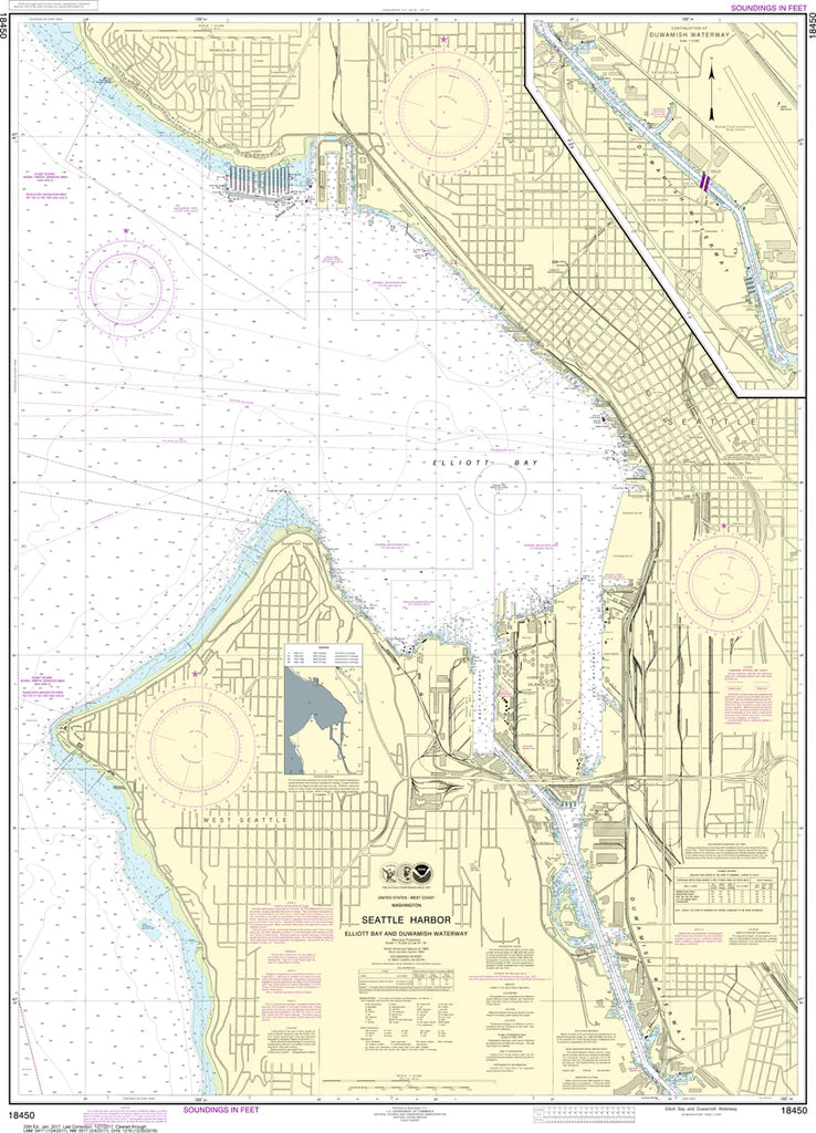
Seattle Harbor (Elliott Bay & Duwamish Waterway) Nautical Chart #18450
Seattle Harbor (Elliott Bay & Duwamish Waterway) Nautical Chart #18450
Couldn't load pickup availability
Share
Bring Seattle’s working waterfront to life in stunning detail with the Seattle Harbor (Elliott Bay & Duwamish Waterway) Nautical Chart #18450. From bustling container terminals and ferry routes to historic piers and tidal channels, this chart puts every navigable inch at your fingertips.
Covering Elliott Bay, the Duwamish Waterway, West Seattle shoreline, Harbor Island, and the industrial heart of the Port of Seattle, it reveals the city’s deep maritime pulse. Explore a waterway shaped by the Klondike Gold Rush era, when Seattle became the gateway for fortune seekers and global trade expansion. Printed at a detailed 1:10,000 scale and measuring an impressive 36" x 49", it’s ideal for display, study, or coastal inspiration.
Perfect for mariners, collectors, and Seattle enthusiasts, this chart brings together practical nautical reference and rich regional character, making it a standout wall piece for offices, boats, and homes alike, whether you’re charting routes or celebrating Puget Sound’s iconic waterfront legacy in vivid, detailed nautical chart detail
(View more detail in nautical chart viewer)
Please note: For decorative and reference purposes only, NOAA has officially sunset traditional paper nautical charts. These legacy charts are no longer updated or approved for primary navigation.
SKU: SKU:NOS18450
View full details