Mitchell Geography
San Juan Islands Reference Map / Poster
San Juan Islands Reference Map / Poster
Couldn't load pickup availability
Share
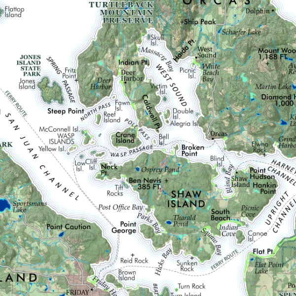
Chart a course through the breathtaking Pacific Northwest with this San Juan Islands Reference Map / Poster, a stunning blend of coastal adventure, nautical history, and wall-worthy design. Packed with intricate geographic detail, this eye-catching map instantly transports you to Washington’s island paradise.
Printed on heavy fine paper in your choice of 20" x 24" (Title on top left) or 13" x 19" (Title across the bottom), this beautifully detailed San Juan Islands map showcases islands, reefs, bays, channels, sounds, ferry routes, trails, roads, and even the region’s four historic lighthouses.
The San Juan Islands have long been a crossroads for Indigenous communities, explorers, and maritime travelers, and the area famously became the center of the quirky “Pig War” border dispute between the United States and Britain in 1859.
Discover iconic destinations like Friday Harbor and Lime Kiln Point State Park while tracing rugged coastlines, hidden coves, and scenic waterways. Perfect for travelers, boaters, hikers, and Pacific Northwest lovers seeking unique map art, coastal décor, or a memorable Washington souvenir.
SKU: SKU:PMG2X0013
View full details