Tom Harrison Maps
San Jacinto Wilderness Hiking Map by Tom Harrison
San Jacinto Wilderness Hiking Map by Tom Harrison
Couldn't load pickup availability
Share
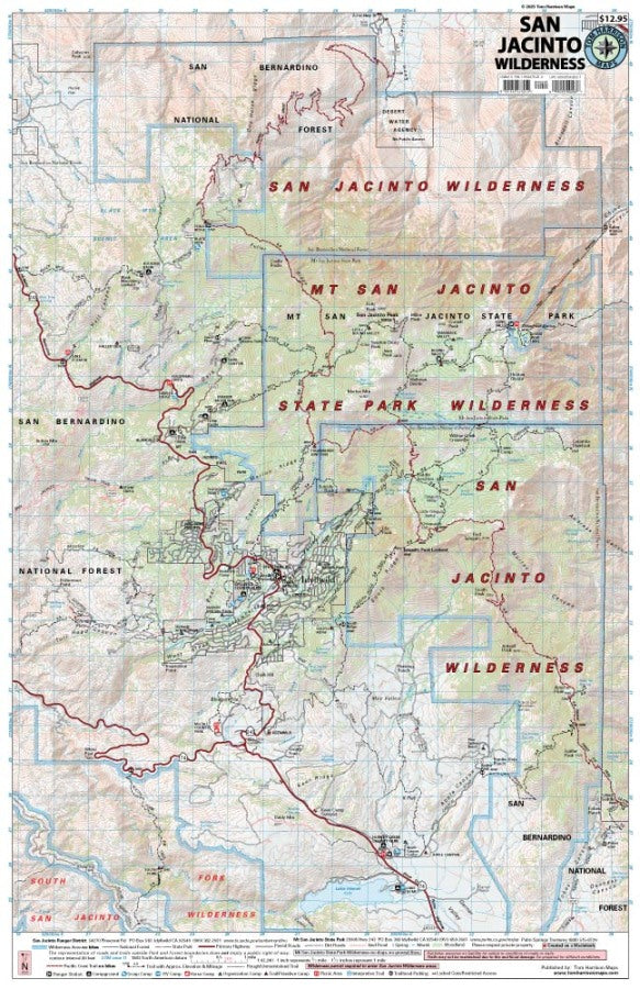
Hit the trails and discover alpine adventures with the San Jacinto Wilderness Hiking Map by Tom Harrison! From pine-scented forests to rugged mountain summits, this detailed hiking map helps you explore Southern California’s spectacular high country with confidence.
Covering Mount San Jacinto State Park and the San Jacinto Wilderness within the San Bernardino National Forest, this essential hiking companion highlights an extensive network of trails, campgrounds, trailheads, and backcountry access points. Follow the popular Mount San Jacinto Peak Trail for breathtaking summit views or explore the scenic trails around Idyllwild. Approaching from the east? The Palm Springs Aerial Tramway offers convenient access to spectacular mountain terrain.
Look for towering pines, fragrant cedars, wildflowers, and wildlife such as mule deer, gray squirrels, and diverse bird species along the way.
With 1:42,240 scale mapping, 80-foot contour intervals, trail mileage, elevation points, ranger stations, trail camps, and access roads, this Tom Harrison hiking map is your reliable guide to planning memorable wilderness adventures.
SKU: SKU:HARSANJAC
View full details