National Geographic
San Francisco City Map & Travel Guide by National Geographic
San Francisco City Map & Travel Guide by National Geographic
Couldn't load pickup availability
Share
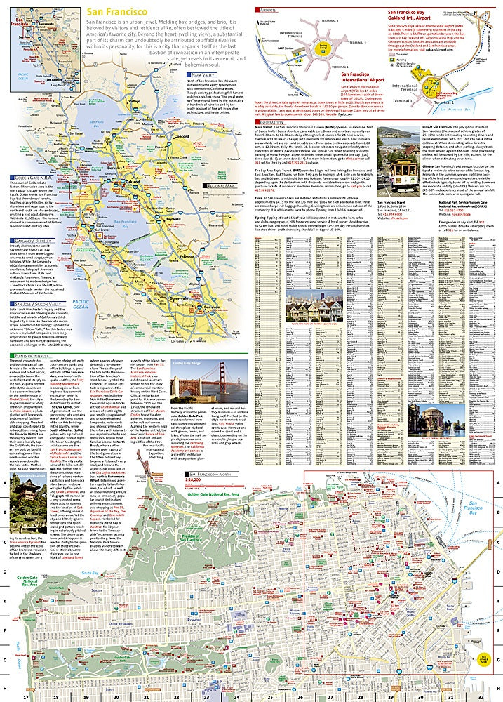
Get ready to explore San Francisco like a local—or a super-savvy tourist! The National Geographic San Francisco City Map & Travel Guide is your ultimate pocket-sized companion to “The City by the Bay.” From the bustling piers of Fisherman’s Wharf to the vibrant streets of Chinatown, the iconic cable cars, and the tech buzz of SoMa, this map puts the city’s best attractions at your fingertips.
The front side zooms in on the eastern neighborhoods, highlighting Civic Center, AT&T Park, and Telegraph Hill, with a handy inset for district details. Flip it over to discover the whole city, including Golden Gate Park, the Palace of Fine Arts, and the Presidio. Need to hop around? BART, rail lines, and cable car routes are clearly marked, plus airport diagrams make travel a breeze.
Printed on waterproof, tear-resistant synthetic paper, this durable map is designed to survive every adventure, from foggy mornings to spontaneous sightseeing detours.
SKU: SKU:NGSDSAN
View full details