1
/
of
2
Tahoe Maps
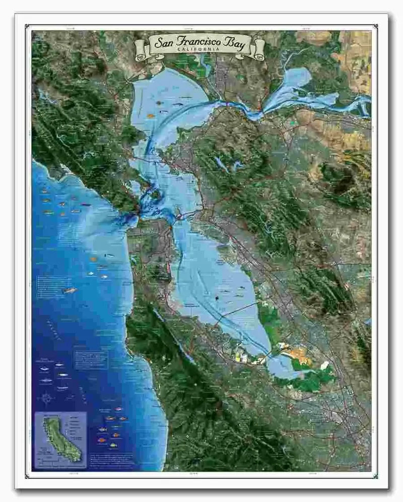
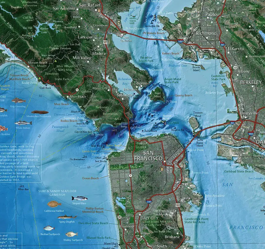
San Francisco Bay Satellite Map
San Francisco Bay Satellite Map
Regular price
$18.95 USD
Regular price
Sale price
$18.95 USD
Unit price
/
per
Couldn't load pickup availability
Share
A beautiful satellite image of San Francisco Bay from Abalone Point and Bolinas to Pescadero Point. It includes all of San Francisco city and County and Alameda County and extends inland to cover the cities of Pittsburg, Pleasanton and most of San Jose. Nice shading for the mountains...great for wall art!
SKU: SKU:TAHSFB
View full details