Mitchell Geography
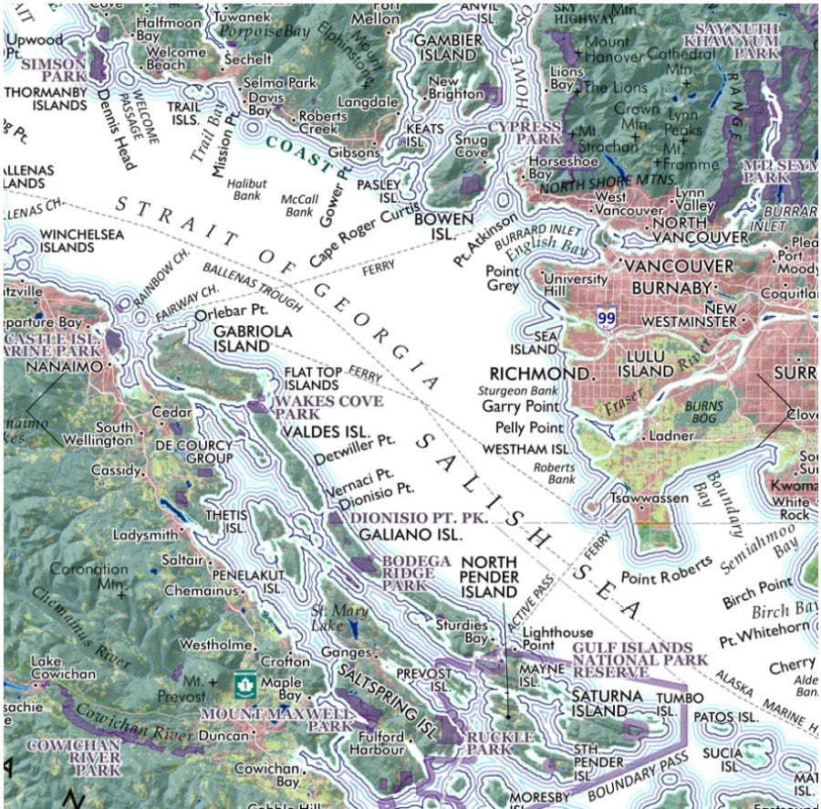
Salish Sea Regional Reference Map
Salish Sea Regional Reference Map
Couldn't load pickup availability
Share
Bring the spectacular waterways of the Pacific Northwest to your wall with the Salish Sea Regional Reference Map—an eye-catching, information-rich map that invites exploration at every glance. From island-studded coastlines to glacier-carved mountains, this beautifully designed map turns geography into art.
Centered on the legendary Salish Sea—the vast inland marine ecosystem formed by the Strait of Georgia, Strait of Juan de Fuca, and Puget Sound—this detailed regional reference map showcases the waterways that link the Pacific Northwest of the United States and Canada. Cities and towns from Vancouver to Olympia anchor the region’s modern population centers, while ferry routes, rivers, islands, peninsulas, and national and provincial parks appear clearly labeled throughout.
The area’s maritime history stretches back thousands of years to Coast Salish peoples who navigated these waters long before European exploration in the late 1700s. Iconic destinations like the San Juan Islands and Olympic National Park highlight the region’s natural beauty.
Printed on heavy fine paper in either 20" x 24" or 13" x 19" (Salish Sea Confluence title - slightly smaller coverage area), the map features stunning color shaded relief topography—making it both a practical geographic reference and a striking piece of wall art.
SKU: SKU:PMG2X0007
View full details