Cairn Cartographics
Rattlesnake Wilderness Recreation Map
Rattlesnake Wilderness Recreation Map
Couldn't load pickup availability
Share
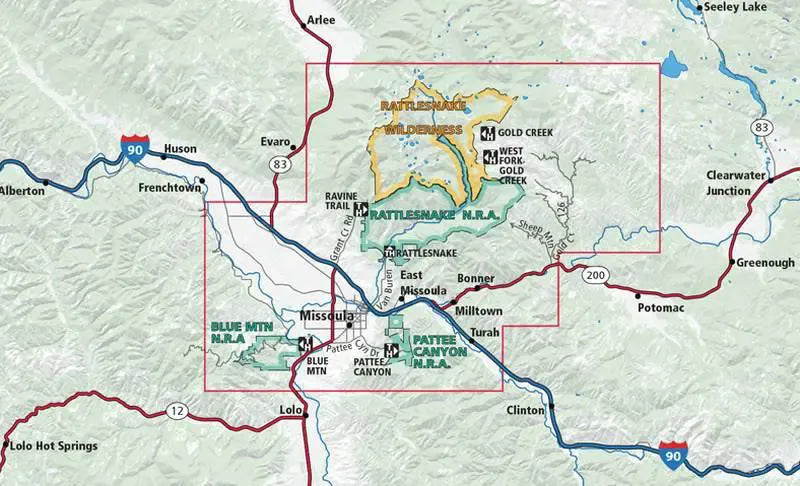
The Rattlesnake Wilderness and Missoula Outdoor Recreation Map by Cairn Cartographics covers the outdoor attractions in the immediate vicinity of Missoula, Montana.
The South portion features Pattee Canyon NRA, Blue Mountain NRA, Woods Gulch and Sawmill Gulch along with a Missoula vicinity map.
The North portion has the Rattlesnake National Recreation Area with it's chain of lakes and wooded mountains. Topography with 100 foot intervals, roads, trails demarcated for pedestrian only, hiker/biker, and horse. Symbols show XC ski areas, trailheads, lookout towers, fishing access and more.
Waterproof, Tearproof and includes Campgrounds, Trail Heads / Trail Mileages and GPS Ready UTM Grids!
SKU: SKU:CAIRW
View full details