NOAA
Puget Sound Nautical Chart #18440
Puget Sound Nautical Chart #18440
Couldn't load pickup availability
Share
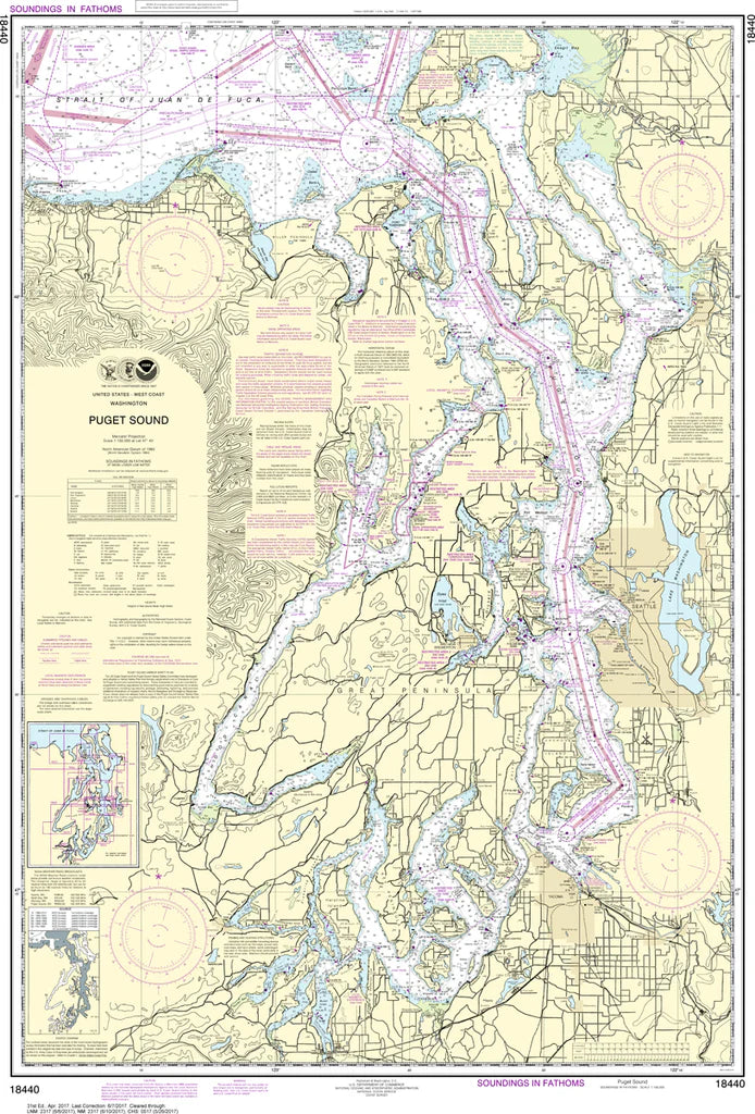
Chart lovers, set your course for Puget Sound—where intricate waterways, island-studded passages, and legendary Pacific Northwest history collide in one stunning navigational display. The Puget Sound Nautical Chart #18440 brings this dynamic marine world to life in crisp hydrographic detail.
Covering Seattle’s busy waterfront, Tacoma’s industrial harbors, Olympia’s southern inlets, the San Juan Islands, Hood Canal, and the Strait of Juan de Fuca, it captures one of America’s most complex coastal networks. At 30" x 43" and a 1:150,000 scale, it offers exceptional clarity for chart study, wall display, or coastal reference. Steeped in maritime heritage, the region reflects centuries of Coast Salish seafaring traditions and later became a strategic hub during World War II with shipbuilding at Bremerton’s Puget Sound Naval Shipyard, shaping modern Pacific trade routes and naval history.
Printed for collectors, educators, and coastal explorers alike, this chart is a timeless wall-worthy reference for understanding the waterways of the Pacific Northwest in stunning detail at home or the office
(View more detail in nautical chart viewer)
Please note: For decorative and reference purposes only, NOAA has officially sunset traditional paper nautical charts. These legacy charts are no longer updated or approved for primary navigation.
SKU: SKU:NOS18440
View full details