Kroll Map Company
Puget Sound Metro Arterial Map
Puget Sound Metro Arterial Map
Couldn't load pickup availability
Share
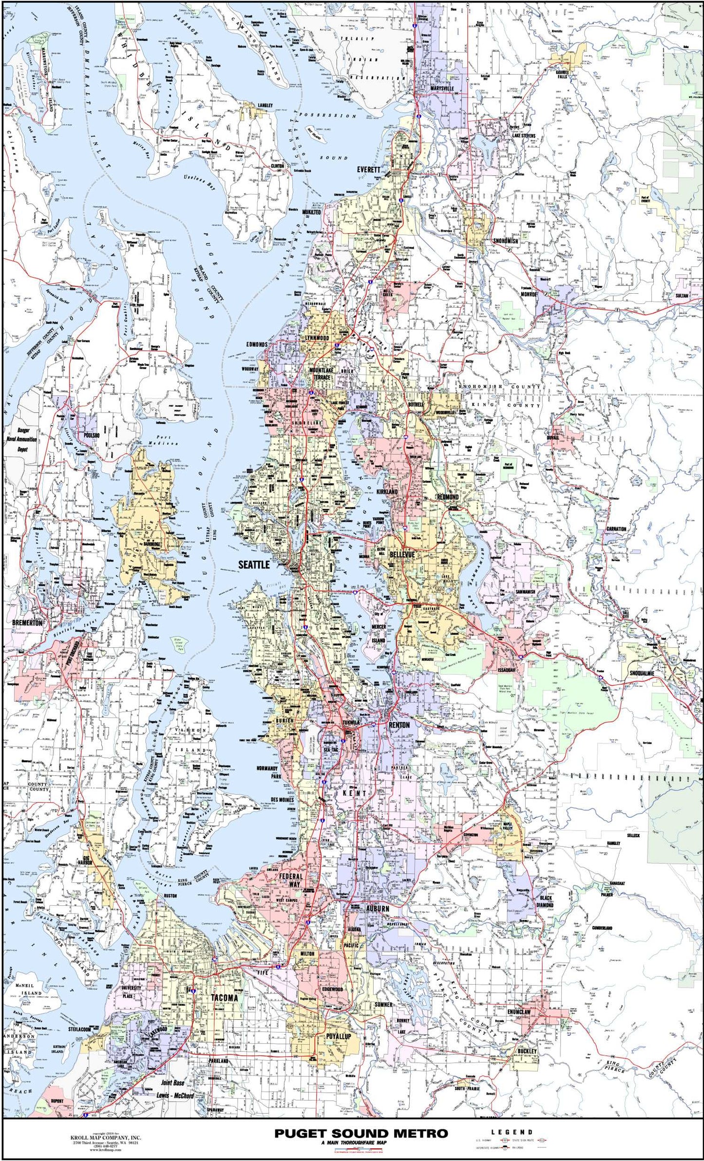
Admire the beauty of the Pacific Northwest with this meticulously crafted Puget Sound Map by the esteemed local publisher, Kroll Map Company. Immerse yourself in the comprehensive details of this Puget Sound Map, showcasing the arterial streets of the region. Stretching from Marysville in the north to Tacoma in the south, and from Bremerton in the west to North Bend in the east, this map encapsulates the essence of the Puget Sound area.
At first glance, this Puget Sound Map paints a vivid picture of the region's main thoroughfares, cities, highways, and interstates. Its careful text placement and attractive color scheme elevate its accuracy, making it an indispensable tool for both locals and visitors. Easily discern the geographical relationship between cities and areas, gaining a deeper understanding of the interconnected web of routes and byways that define the Puget Sound.
One of the remarkable features of this Puget Sound Map is its ability to encompass not just the urban sprawl but also the enchanting natural beauty of the area. Nestled within the intricate road network, you'll find the names of waterways, parks, and golf courses, allowing you to plan scenic routes and outdoor adventures. The careful cartographic detailing transforms this map into a versatile guide, ideal for both travel enthusiasts and professionals seeking a comprehensive view of the region.
Choose from two convenient sizes, 2'x3' or 3'x5', to suit your specific needs. Whether you prefer the practicality of paper or the durability of laminated material, this Puget Sound Map promises enduring quality. Hang it in your office, study, or living room and let it serve as a perpetual source of knowledge, beckoning you to explore the unique allure of the Puget Sound area.
SKU: SKU:KROPSM
View full details