NOAA
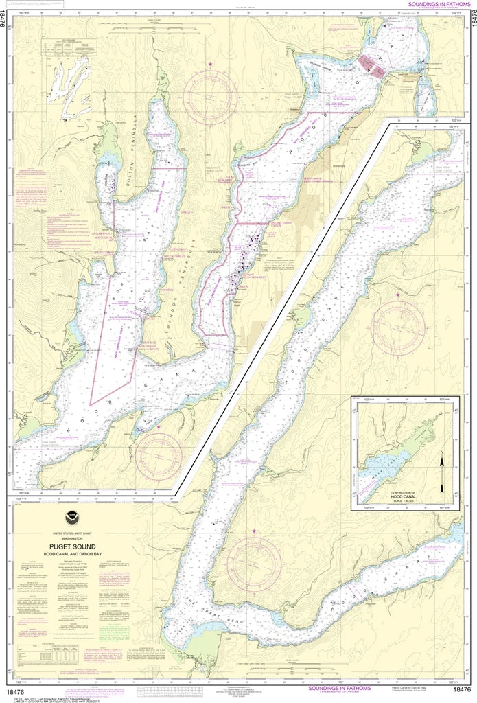
Puget Sound (Hood Canal and Dabob Bay) Nautical Chart #18476
Puget Sound (Hood Canal and Dabob Bay) Nautical Chart #18476
Couldn't load pickup availability
Share
Chart a course through one of Washington's most breathtaking waterways with Puget Sound (Hood Canal and Dabob Bay) Nautical Chart #18476! Whether you're a sailor, boater, kayaker, fisherman, or chart collector, this classic NOAA chart is a stunning blend of maritime history and coastal adventure.
Covering the spectacular Hood Canal and the tranquil waters of Dabob Bay, this detailed chart showcases one of the Pacific Northwest's most scenic marine destinations. Explore the shoreline near Hoodsport, Quilcene, Brinnon, Pleasant Harbor, and the surrounding inlets, coves, and anchorages that have long attracted boaters and wildlife enthusiasts alike.
Hood Canal is famous for its rich shellfish beds, dramatic Olympic Mountain backdrop, and deep fjord-like waters. Historically, the canal was named by British explorer Captain George Vancouver in 1792 during his expedition to chart the Pacific Northwest coastline. Measuring 32" x 47" at a detailed 1:40,000 scale, this chart is ideal for display, education, or maritime collections.
(View more detail in nautical chart viewer)
Please note: For decorative and reference purposes only, NOAA has officially sunset traditional paper nautical charts. These legacy charts are no longer updated or approved for primary navigation.
SKU: SKU:NOS18476
View full details