Rand McNally
Pennsylvania State Highway Laminated Map Rand McNally - Easy to Fold
Pennsylvania State Highway Laminated Map Rand McNally - Easy to Fold
Couldn't load pickup availability
Share
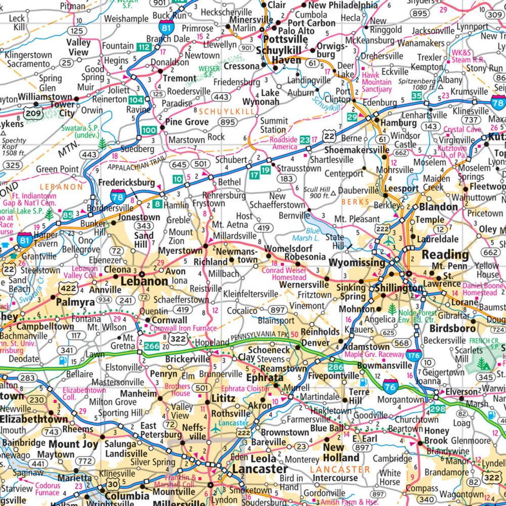
Discover the Keystone State like never before with the Rand McNally Pennsylvania State Highway Laminated Map, designed to be your ultimate travel companion. Durable, tear-resistant, and easy to fold, this heavy-duty laminated map lets you plan your route, mark stops, and make notes without worrying about spills or wear. Perfect for road trips, whether you're navigating major highways or exploring hidden gems, it ensures you stay on track every mile of your journey.
Did you know Pennsylvania boasts over 120,000 miles of roads? Use this map to uncover lesser-known treasures like the charming town of Jim Thorpe, a picturesque destination filled with Victorian architecture, scenic trails, and unique local shops. Featuring full-color, easy-to-read maps with clearly indicated highways, county boundaries, points of interest, and a quick-reference city index, it’s ideal for both residents and visitors. Make every Pennsylvania road trip smoother, smarter, and more memorable with this essential laminated map.
SKU: SKU:RMCUSPAE
View full details