Rand McNally
Pennsylvania State Highway Folded Map by Rand McNally - Easy to Read
Pennsylvania State Highway Folded Map by Rand McNally - Easy to Read
Couldn't load pickup availability
Share
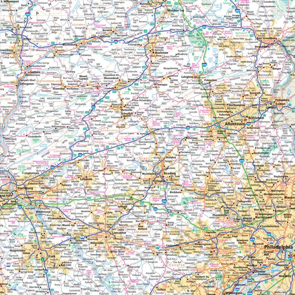
Hit the road with the Pennsylvania State Highway Folded Map by Rand McNally, your ultimate companion for exploring the "Keystone State"! Whether you're chasing big cities, quaint towns, or scenic byways, nothing beats having a reliable paper map in hand to plan your trip, avoid wrong turns, and uncover hidden gems along the way. Known as the Keystone State, Pennsylvania is full of iconic spots, but don’t miss Mercer County’s quirky Little League Museum—a fun, off-the-beaten-path stop for road trippers.
Rand McNally’s Easy to Read map gives you clear, accurate coverage of all Interstates, U.S., state, and county highways, plus parks, airports, points of interest, and county lines. With a user-friendly legend, full-color detail, mileage and driving times, and a convenient folded size, it’s perfect for quick navigation and planning spontaneous adventures. Updated regularly, this map makes every Pennsylvania road trip smarter, smoother, and more memorable.
SKU: SKU:RMCUSPA
View full details