International Travel Maps
Pakistan Travel Map by ITMB
Pakistan Travel Map by ITMB
Couldn't load pickup availability
Share
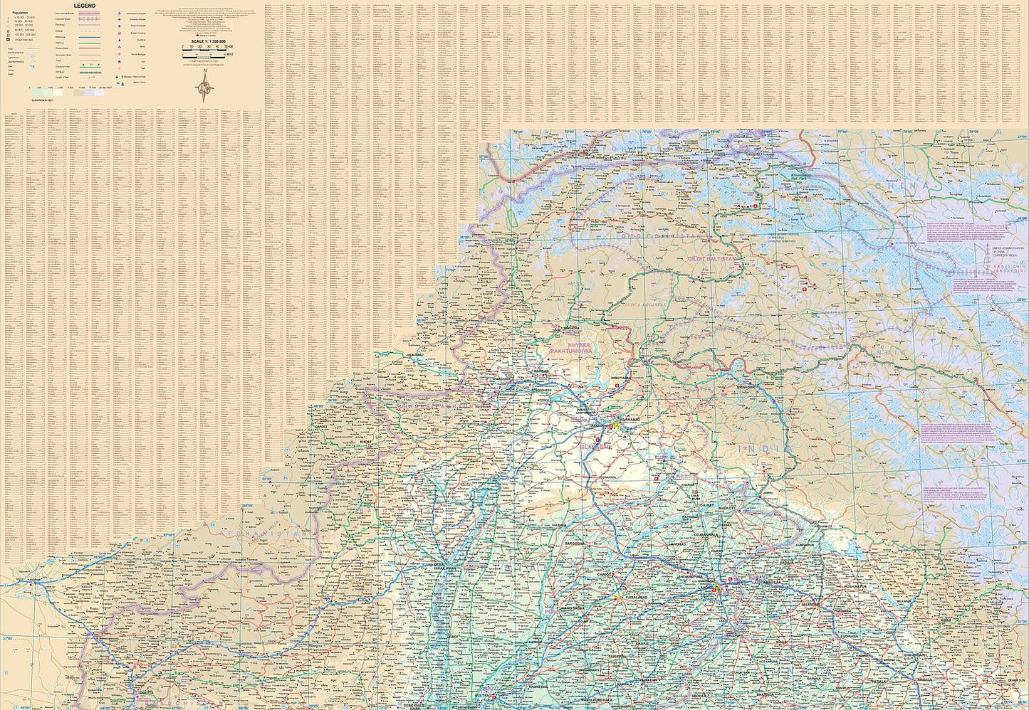
Discover the rich cultural heritage and diverse geography of Pakistan with ITMB’s double-sided, folded Pakistan Travel & Reference Map, scaled at 1:1,200,000. Designed for both travelers and researchers, this map offers an in-depth look at a country shaped by a complex history and vibrant present. Side 1 covers the southern region, featuring an inset of Karachi—Pakistan’s sprawling port city and commercial hub—along with updated road networks and border zones shared with Iran, Afghanistan, and India. The south is ideal for exploring the varied terrain from coastal plains to desert landscapes.
Side 2 presents the mountainous north, where the adventure truly begins. Navigate through the high-altitude splendor of the Hunza Valley, trace the dramatic Karakoram Highway toward China, or explore the historic heart of Lahore, renowned for its Mughal architecture and cultural depth. Islamabad, the modern capital, also stands out with its green spaces and planned cityscape. Despite ongoing tensions in Kashmir—clearly marked on the map—many areas of Pakistan are peaceful and welcoming to visitors.
Map features include national parks, rivers, lakes, airports, highways, and key attractions. Printed on durable stock at 27" x 39", this map is a practical and visually detailed guide to one of South Asia’s most underrated destinations.
SKU: SKU:ITMPAK
View full details