National Geographic
Pacific Crest Trail - Washington North Topo Map Guide Booklet #1002
Pacific Crest Trail - Washington North Topo Map Guide Booklet #1002
Couldn't load pickup availability
Share
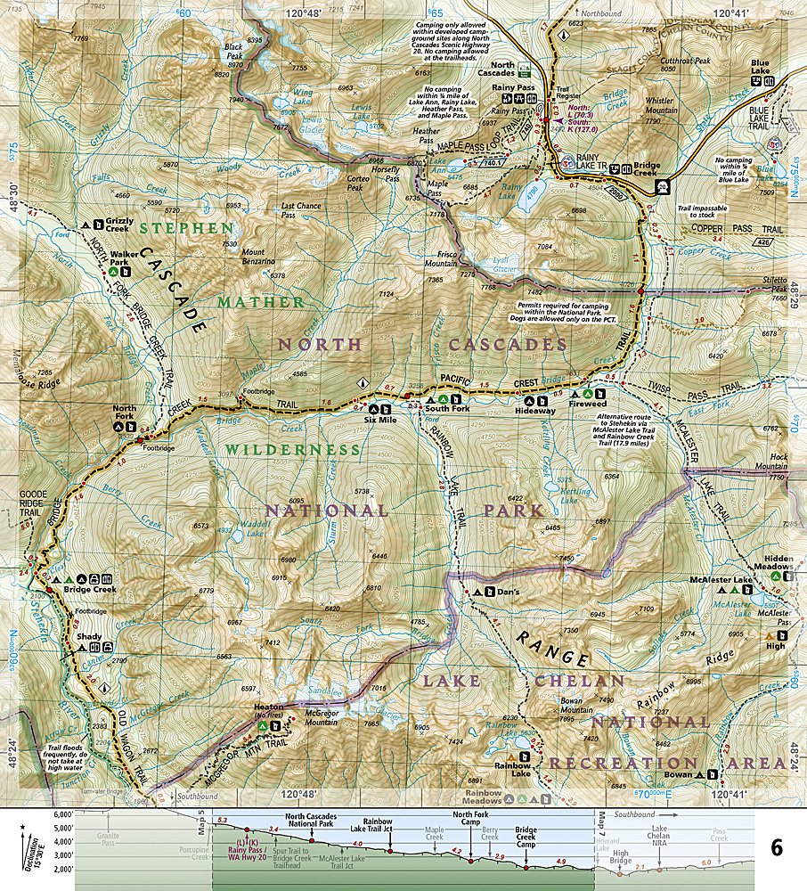
Ready to conquer the wild heart of the Cascades? National Geographic’s Pacific Crest Trail – Washington North Trails Illustrated Topographic Map Guide (#1002) takes you through the most dramatic and untamed section of the PCT—from the Canadian border to Snoqualmie Pass—where snowcapped peaks, glacial valleys, and misty forests define every mile.
Discover trail icons like Glacier Peak, the remote Pasayten Wilderness, and the jaw-dropping Knife’s Edge near Mount Adams. Hike through territory once explored by early gold prospectors and fire lookouts, and see why this region still lures modern-day adventurers chasing solitude and panoramic alpine views.
This waterproof, tear-resistant booklet keeps you on track with detailed topographic maps (nearly 1" = 1 mile), overlapping page layouts, and handy elevation profiles showing campsites, water sources, and access points. Lightweight, compact, and built “Backcountry Tough,” it’s the perfect partner for section hikers, thru-hikers, or anyone ready to experience the rugged beauty of Washington’s legendary PCT miles—one breathtaking step at a time.
SKU: SKU:TRA1002
View full details