International Travel Maps
Pacific Crest Trail Travel Map
Pacific Crest Trail Travel Map
Couldn't load pickup availability
Share
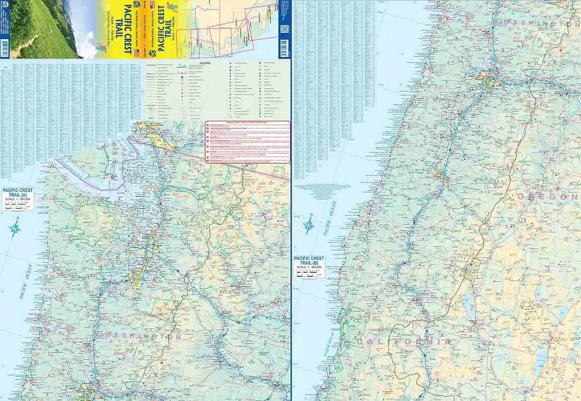
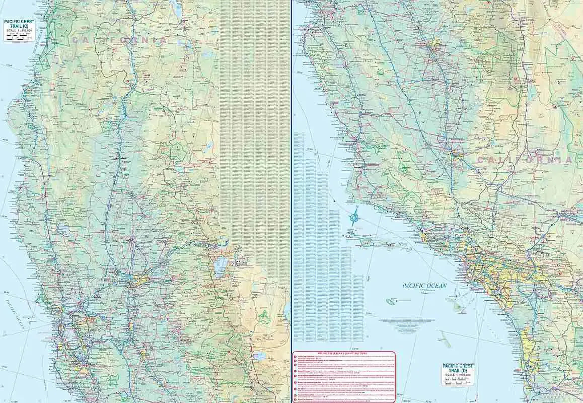
Pacific Crest Trail Travel Map: The Pacific Crest Trail (PCT) is an iconic and challenging hiking route that spans from the California-Mexico border to Canada, covering over 1,600 miles. ITMB’s double-sided, waterproof Pacific Crest Trail Travel Map captures the sweeping scale of this legendary trek with a detailed 1:900,000 scale, making it one of the few maps that depict the entire trail. This overview map serves as a valuable planning tool for anyone captivated the dramatic landscapes and diverse ecosystems the trail passes through.
Notable highlights include California's Mount Whitney, the tallest peak in the contiguous United States; Crater Lake in Oregon, renowned for its breathtaking clarity and unique volcanic formation; and Washington’s North Cascades National Park, known for its rugged beauty and alpine lakes. Each side of the map is packed with essential features, including roads, rivers, lakes, national parks, airports, and other significant points of interest.
While not designed for day-to-day navigation, this map is ideal for visualizing the expansive route and planning for an unforgettable journey. Lightweight and durable, it’s an excellent companion for those dreaming of or preparing for a Pacific Crest adventure.
SKU: SKU:ITMPCT
View full details