National Geographic
Pacific Crest Trail - Sierra Nevada South Topo Map Guide Booklet #1009
Pacific Crest Trail - Sierra Nevada South Topo Map Guide Booklet #1009
Couldn't load pickup availability
Share
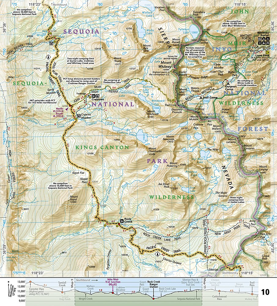
Conquer the legendary Pacific Crest Trail with National Geographic’s Sierra Nevada South Trails Illustrated Topographic Map Guide Booklet #1009 — your ultimate hiking companion for one of the most breathtaking sections of the PCT! From the granite peaks of Sequoia National Park to the alpine lakes of Kings Canyon and the mighty Forester Pass — the highest point on the entire trail at 13,160 feet — this guide keeps you on track through some of the most iconic backcountry on Earth.
Follow the same rugged path as John Muir himself, where the PCT and John Muir Trail share 160 miles of jaw-dropping vistas, wildflower-filled meadows, and towering conifers. This waterproof, tear-resistant, and GPS-ready booklet includes detailed topographic maps, elevation profiles, and resupply info — all perfectly designed for pack or pocket.
Whether you’re a thru-hiker chasing the full 2,650-mile dream or just exploring a few alpine miles, this map guide is your ticket to high Sierra adventure!
SKU: SKU:TRA1009
View full details