National Geographic
Pacific Crest Trail - Shasta and Lassen Topo Map Guide Booklet #1007
Pacific Crest Trail - Shasta and Lassen Topo Map Guide Booklet #1007
Couldn't load pickup availability
Share
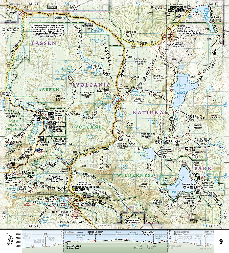
Gear up for one of Northern California’s most epic hiking adventures! The Pacific Crest Trail – Shasta & Lassen Trails Illustrated Topographic Map Guide Booklet #1007 by National Geographic is your ultimate trail companion through volcanic peaks, ancient forests, and jaw-dropping wilderness.
Follow the PCT as it winds past the thundering cascades of McArthur-Burney Falls Memorial State Park, the spires of Castle Crags, and the steaming hydrothermal features of Lassen Volcanic National Park. This region once echoed with volcanic eruptions that shaped today’s dramatic landscape—perfect terrain for trekkers chasing both history and adventure.
Built “Backcountry Tough” with waterproof, tear-resistant paper, this compact booklet features detailed topographic maps at nearly 1 inch = 1 mile, GPS-compatible UTM grids, and easy-to-read trail profiles. Whether you’re section-hiking between Bucks Lake and Hat Creek Rim or tackling the whole 2,650-mile PCT, you’ll have all the essentials—resupply points, elevation profiles, and camping details—right in your pack. Lightweight, durable, and ready for every step of your journey!
SKU: SKU:TRA1007
View full details