National Geographic
Pacific Crest Trail - Scodie, Piute & Tahachapi Mtns Topo Map #1010
Pacific Crest Trail - Scodie, Piute & Tahachapi Mtns Topo Map #1010
Couldn't load pickup availability
Share
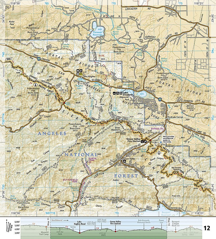
Hit the trail with confidence and explore Southern California’s wildest backcountry with National Geographic’s Pacific Crest Trail – Scodie, Piute & Tehachapi Mountains Trails Illustrated Topographic Map Guide Booklet #1010! From the southern Sierra Nevada foothills to the Tehachapi Mountains and the Mojave Desert, this map guides you through some of the region’s most scenic and historic landscapes. Trek past the rugged Piute Mountains, soak in the views at Walker Pass, and marvel at the Tehachapi Loop—a historic railroad engineering marvel.
Covering the PCT’s lower elevations, this guide is perfect for winter, spring, and fall hiking when temperatures are just right. Each page features detailed topographic maps at nearly 1 inch = 1 mile, trail profiles showing distances between camping areas, trailheads, and points of interest, plus resupply locations and safety tips. Printed on waterproof, tear-resistant “Backcountry Tough” paper, it’s compact, durable, and designed for every adventurer—from day hikers to thru-hikers. With full UTM grids for GPS navigation, you’ll never miss a beat while exploring California’s deserts, mountains, and legendary trail vistas.
SKU: SKU:TRA1010
View full details