National Geographic
Pacific Crest Trail - San Jacinto & Laguna Mtns Topo Map Booklet #1012
Pacific Crest Trail - San Jacinto & Laguna Mtns Topo Map Booklet #1012
Couldn't load pickup availability
Share
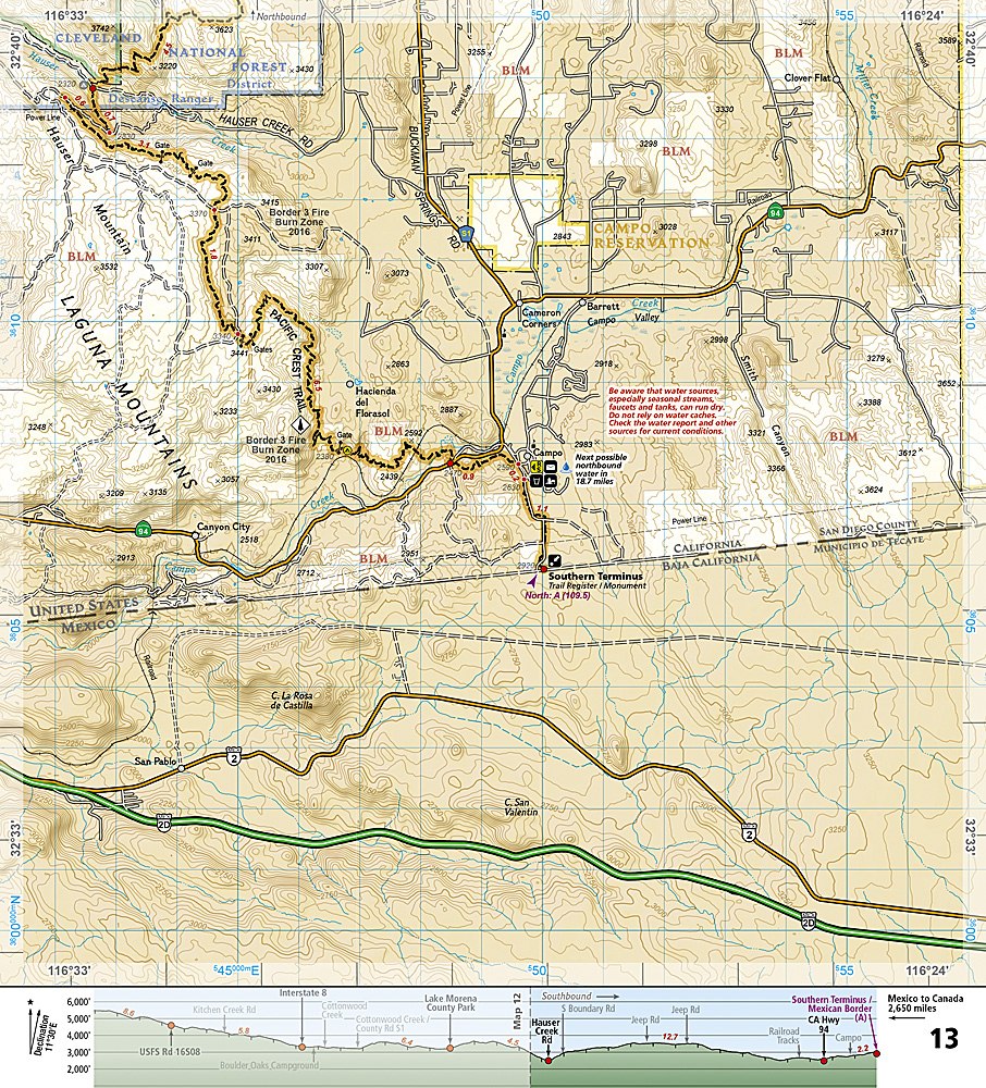
Explore Southern California’s wildest trails with National Geographic’s Pacific Crest Trail – San Jacinto & Laguna Mountains Trails Illustrated Topographic Map Guide Booklet #1012. This hiker’s essential guide covers the PCT from San Gorgonio Pass through the towering San Jacinto Mountains, across the rugged Laguna Mountains, and down to the Mexican border. Discover top attractions like San Jacinto Peak, Mount Laguna’s panoramic viewpoints, and the historic Julian gold rush town, all mapped in vivid detail.
Designed for day hikers, weekend adventurers, and thru-hikers, this guide features detailed topographic maps at nearly 1 inch per mile, overlapping pages for seamless navigation, and full trail profiles showing distances, shelters, and camping spots. Durable, waterproof “Backcountry Tough” paper and a full UTM grid make it perfect for off-trail exploration. Whether trekking snow-dusted peaks or desert rangelands, this compact, lightweight booklet keeps you safe, informed, and on course. Conquer Southern California’s most scenic PCT sections with confidence using this must-have hiking map.
SKU: SKU:TRA1012
View full details