National Geographic
Pacific Crest Trail - San Gabriel & San Bernardino Mtns Topo Map #1011
Pacific Crest Trail - San Gabriel & San Bernardino Mtns Topo Map #1011
Couldn't load pickup availability
Share
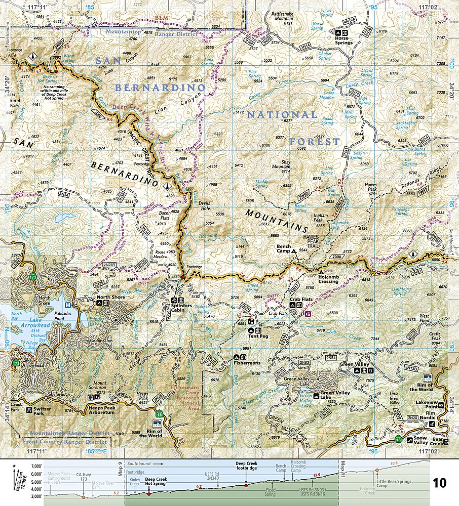
Get ready to conquer Southern California’s wildest peaks with National Geographic’s Pacific Crest Trail – San Gabriel & San Bernardino Mountains Trails Illustrated Topographic Map Guide Booklet #1011! Perfect for hikers craving adventure, this guide lets you navigate the Sierra Pelona’s scrublands, ascend the pine-clad San Gabriels, and take in the breathtaking vistas of San Gorgonio Pass, Los Angeles Basin, and the Mojave Desert.
Steeped in history, these ranges were traversed by early settlers and Native Americans long before the PCT officially opened. Your trek can include top attractions like Mount San Antonio (Old Baldy), Angeles National Forest scenic viewpoints, and San Gorgonio Peak, the tallest point in Southern California.
Designed for every hiker, this compact booklet features detailed topographic maps at nearly 1 inch = 1 mile, with trail profiles showing distances between trailheads, campsites, and key landmarks. Printed on “Backcountry Tough” waterproof, tear-resistant paper, it even includes UTM grids for GPS users. Whether you’re day hiking or thru-hiking, this guide keeps you on track, mile by rugged mile, in one of the country’s most iconic trail systems.
SKU: SKU:TRA1011
View full details